In another post, I showed you amazing free sites online that can help with character development. For some books, though, the physical environment is a character itself, and it needs to be developed just as thoroughly—but differently.
Here are some tools for where (and when) your story might take place:
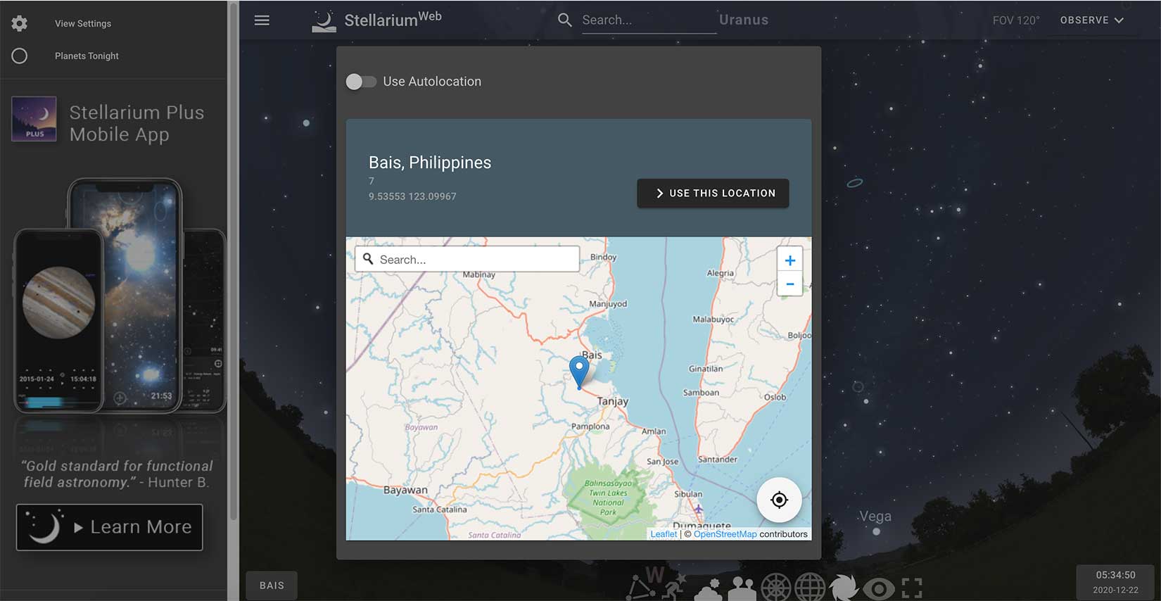
 On my character development page, I talk about the usefulness of Timeanddate.com for moon phases, but—oh my—move over T&D because there’s a new web technology in the house, and it’s awesome, in the traditional grand scope of that word. Meet the Stellarium online star map.
First, choose your setting: click on the left corner rectangle that probably starts with “unknown” or maybe your current location. You can add in an address, or even just a city, and move the pointer exactly where you want it. Below is the location for my fictional San Honorato chapel.
Then choose your date and time with the controls that pop out of the bottom right corner. The slider shows you how the sky changes over the course of the evening.
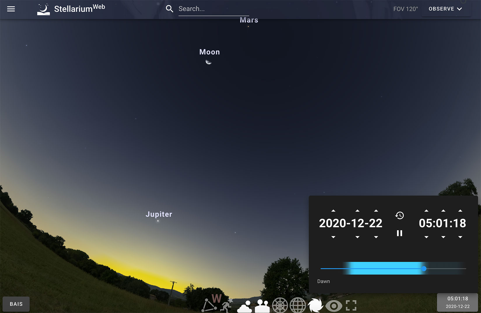
And then, wow. You’re there. Just like your characters. Amazing! You can ask the program to draw constellations for you, to represent them artistically, or even to take the ground away altogether.
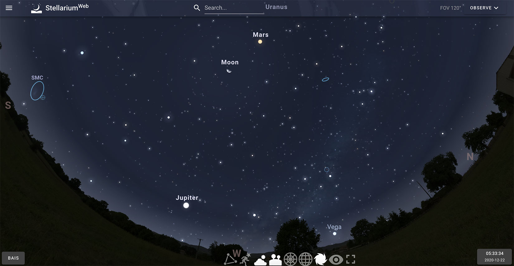
I have just barely scratched the surface, and no doubt there are many other amazing features. For example, if you want to take this outside to use for your night sky, choose the night view button that makes the screen red and black to help your eyes stay adjusted and avoid light pollution for gazing. Go play.
 Tides4Fishing will give you detailed information on the rising and setting of the sun, solunar activity, moon phase, and astronomical observation data. However, it is best used for tidal data like the name suggests. How many beach-set books forget to talk about high tide or low tide? Yet it is the first thing you notice when you are actually on a beach because it determines how much sand you have right in front of you.
This site only has historical data back a few years, but I find that if you generally get the right time of year and the right moon phase, it works well enough.
I have found no better weather site than WeatherSpark.com—not for your immediate forecast, but for average historical data? You bet. (You can also check out the Farmer’s Almanac website here.)
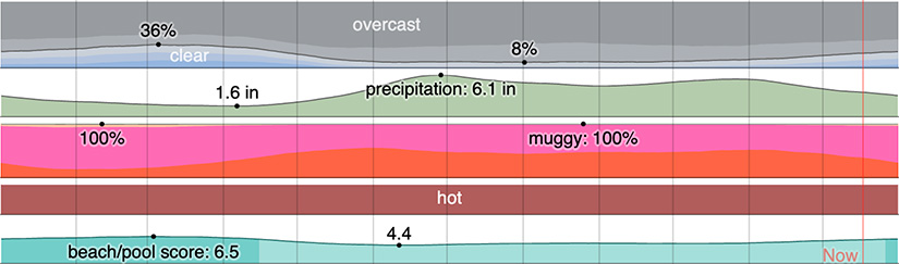
The diagram above has a little of everything they offer: from clouds in the sky to precipitation, humidity, temperature, and “beach/pool score” (defined as the number of “clear, rainless days with perceived temperatures between 75°F and 90°F”). Honestly, it is also useful for vacation planning.
Have you ever thought to yourself, “How likely would it precipitate on such-and-such a date?” Now you can snow in your couple at a lovely cabin in Aspen over Thanksgiving, assured that this plot device is totally plausible. I love forced proximity romances, by the way, so gimme.

If you are in the United States or its territories (or former territories), the National Oceanic and Atmospheric Administration allows you to search historic weather data. Great stuff! There is also a Climate.gov database.
For those outside the United States, there are some excellent sites to consider.
For those writing in the UK, climate policy and history writer Kate Zerrenner suggests the following two amazing sites. They share data sources, but are arranged a little differently. First there is Weatherweb.net & Martin Rowley’s “Weather in History” which is organized by many increments, making it easily navigable. The Isles Project uses Rowley and other historical sources on weather to put everything in one place. It only has four date indices: (1) 11,000 BCE to 1099 CE; (2) 1100 to 1598; (3) 1600 to 1849; and (4) 1850 to 2007 (July). [I suppose nothing happened in 1599?]
A resource I have used a lot for my books in the Philippines is the Selga Chronology on typhoons. It has two pages: (1) 1348 to 1900; and (2) 1901-1934.
Most other “historical” weather sites reach back only to the 1970s, but if you have found some that dig deeper, please contact me on social media or via email and let me know. I will add them here!
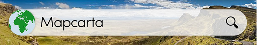
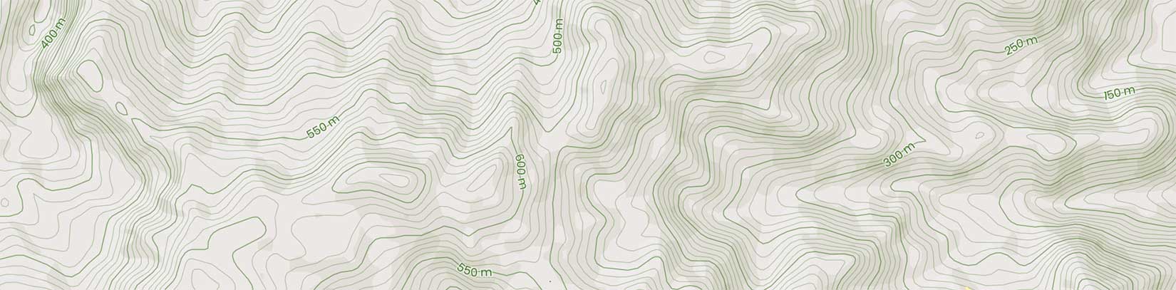
Everyone uses Google Maps, and so do I. But for authorly things I often prefer Mapcarta. This free service uses OpenStreetMap and Wikipedia, but this is one of the clearest topographic maps I have found, especially as the topography can be laid directly over a street map.
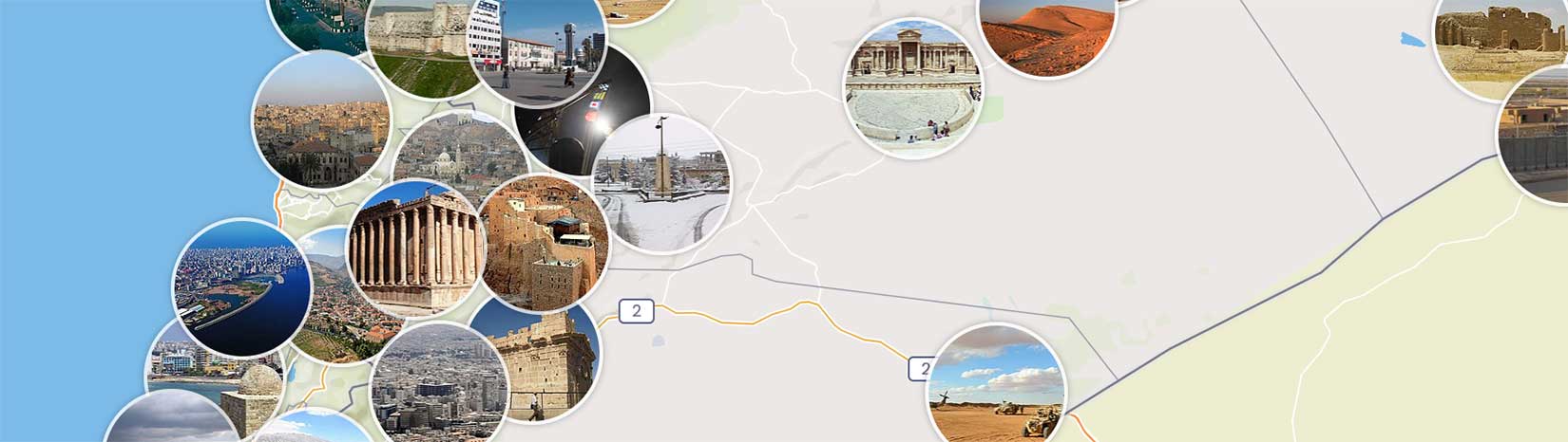
Or . . . what if you do not know exactly where you want to locate your story? You need someone to lay photos over the map, like VH1s old Pop-Up Video, so you can choose a location. Mapcarta has done exactly that but (sadly?) without the 80s music. As you linger over one of the circles, the site will enlarge it and even give you a big close-up.
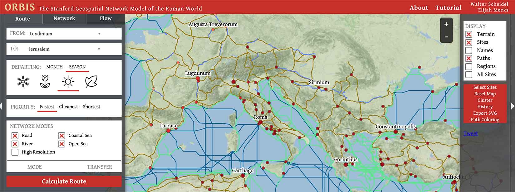
 Mr. H found this one for me called Orbis: The Stanford Geospatial Network Model of the Roman World. I will use it more in my teaching than my writing, but it may be useful to you. If you write in ancient Rome, this allows you to calculate journey times and costs of travel. That’s wicked cool.
Making up a place? We can reuse a source mentioned in the character tools section, only this time it will help us create town names! And it is not the only one available. Check out this one for fantasy, which even has a Southeast Asian town generator, along with other geographical regions. Or this one from ChaoticShiny. And use this one for real (but lesser-known) places around the globe. Use them appropriately, remembering that if you use a real place (Google it!) then you need to do the work to represent it accurately.
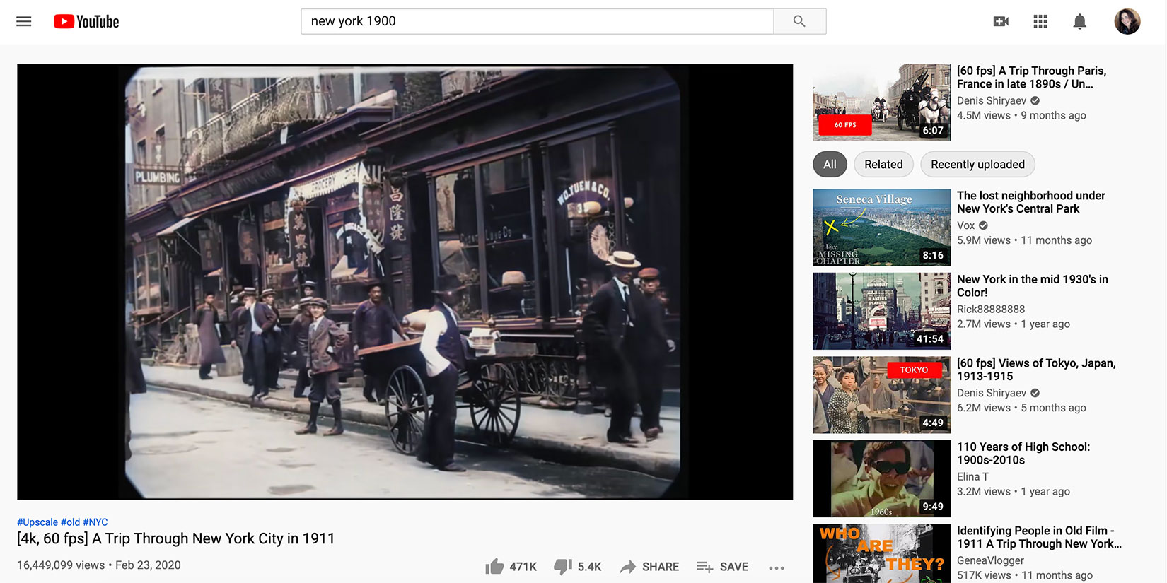
Don’t forget the obvious. YouTube is owned by Google, which is why I recommend using the Google Video search bar. This gives you more tools to limit your results, though beware that date refers to date uploaded. I searched “New York 1900” and look what I found:
Another quick tip: use social media like Instagram and Facebook to search places for user photos too!
For historical authors, detailed maps of how cities used to look are essential. For example, Locating London’s Past, with GIS-compliant data-rich maps is a great resource for those setting their book there. For other cities, a specific Google search may be your first stop. Your second stop? Your target city’s library and any digital map collections they might have.
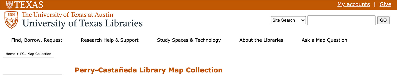
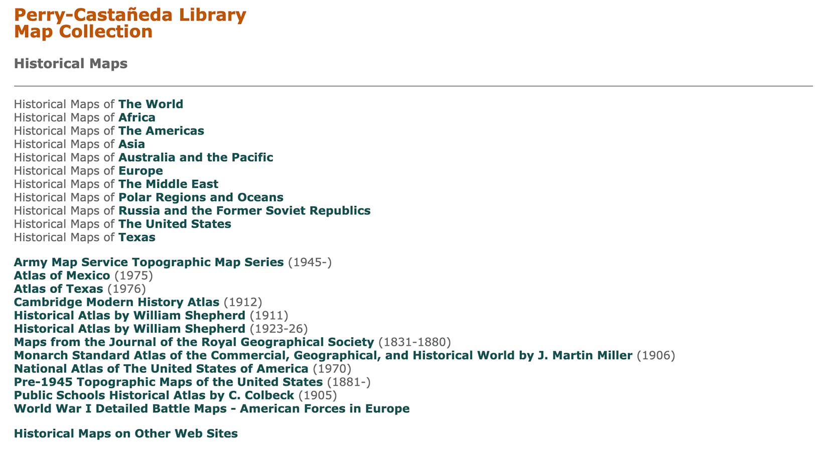
But where next? Try the University of Texas at Austin’s Perry-Castañeda Library Map Collection. They have maps from all over the world, on topics from population to transportation to history. You can start by browsing their curated collections:
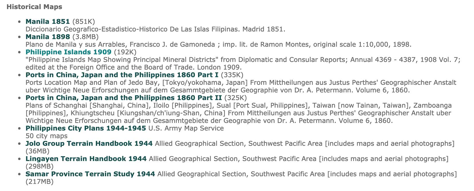
Or you can search for a particular country and look at everything they have. This is the current collection of historical maps on the Philippines:
Most of these maps are government publications, which means they were never in copyright and can be used in commercial publications.
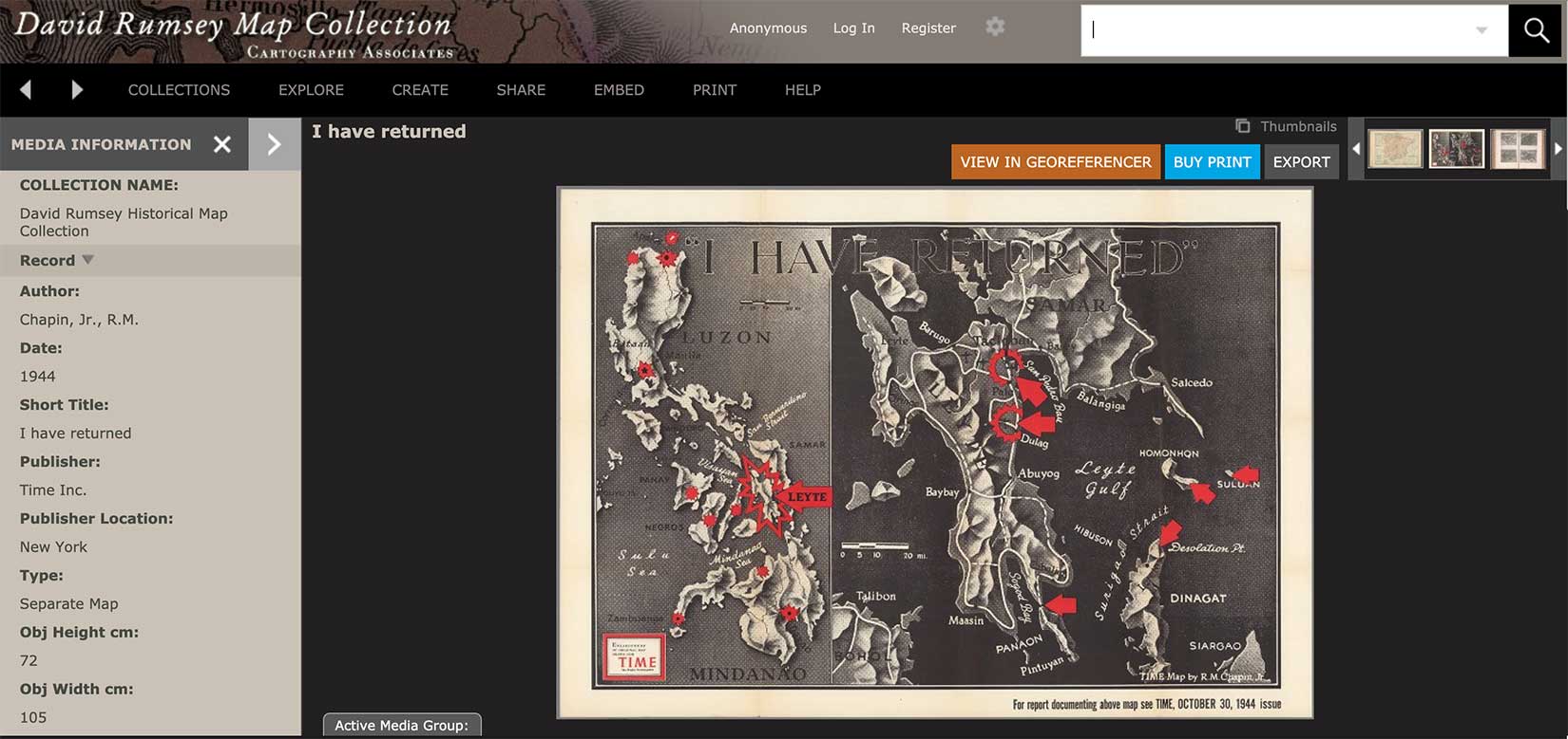
If you want privately published maps—many of which are out of copyright and may be downloaded in high-resolution files—check out David Rumsey‘s collection. Most of the downloads are free, but you can purchase prints, even framed prints, directly from the site. With maps like this one from Time, I can see the appeal.
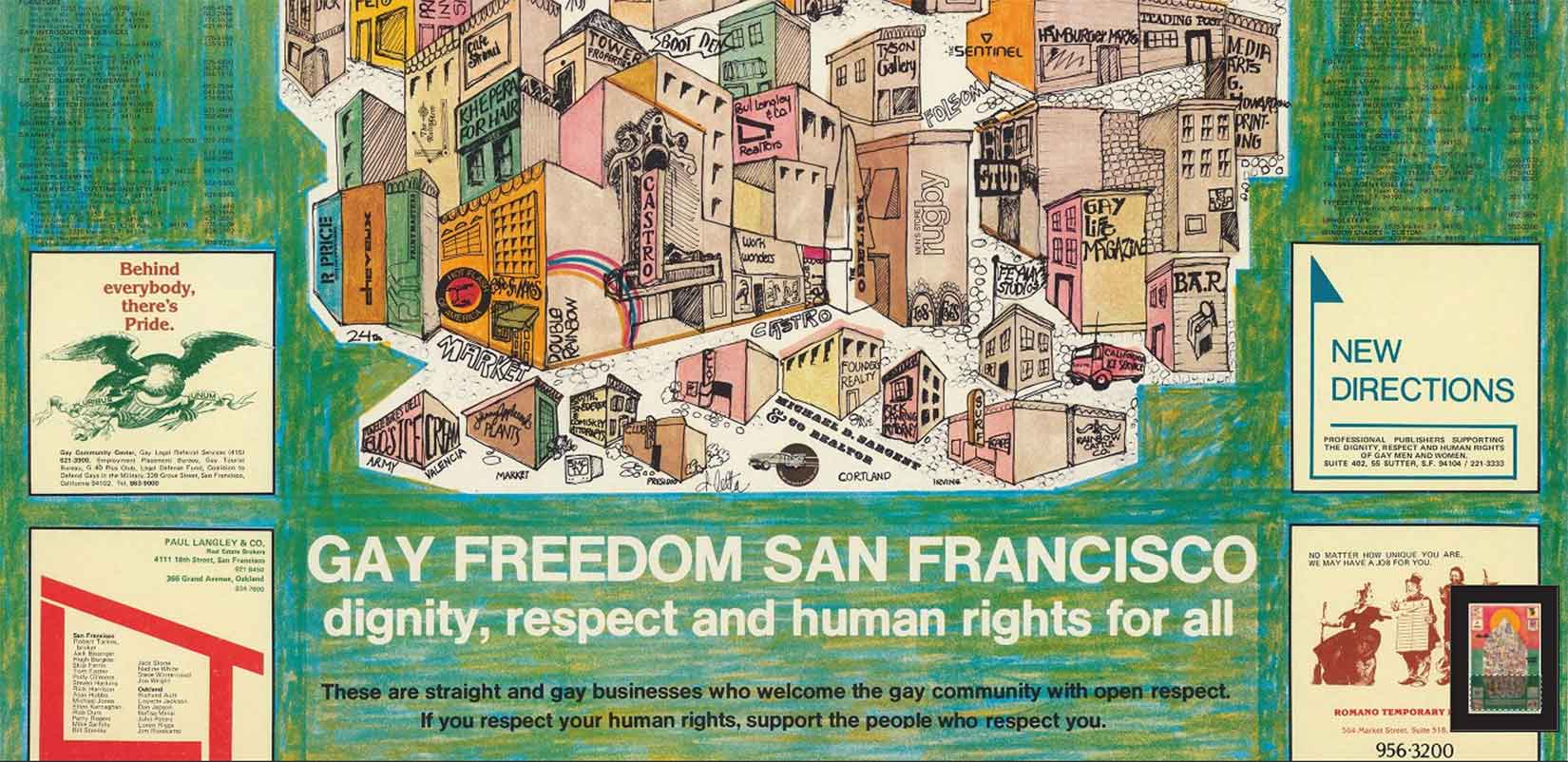
There are also maps that function more like posters, like this one from the Gay Freedom San Francisco movement in 1980:
I found excellent historical maps of Boston in this collection, and I used these to help construct the backstory of my first heroine, Georgina Potter. I knew her address before the story began, though it never once came up in the book itself. Does anyone else go a little too deep into their characters’ backstories, even if just in their heads? Okay, maybe it’s just me.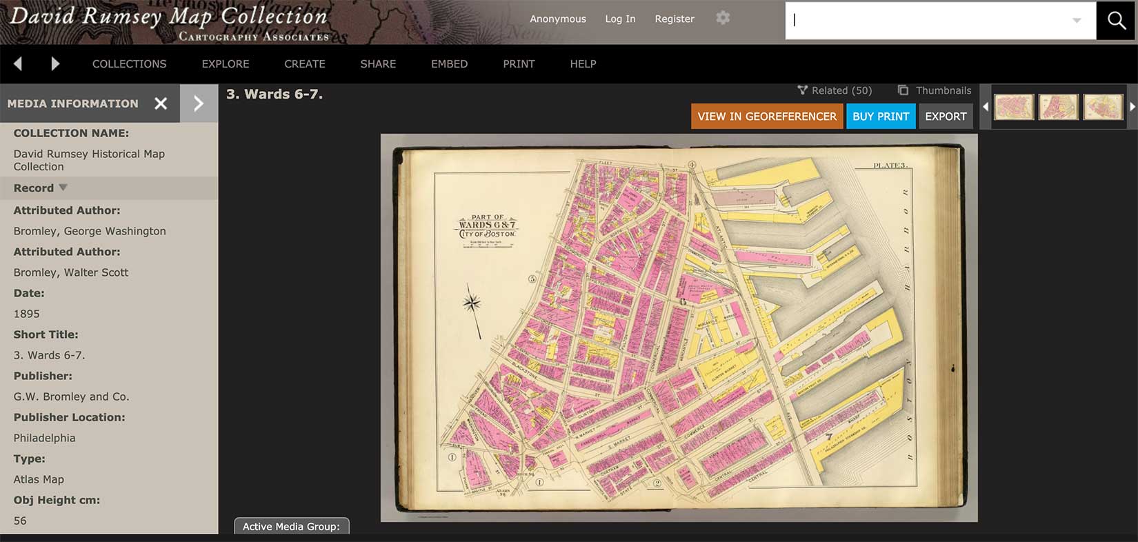
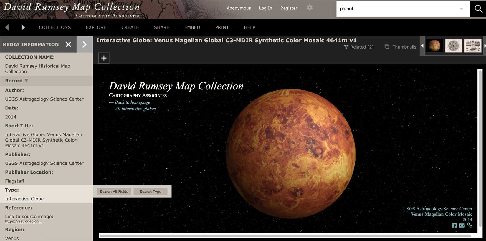
And if you are not writing historicals? What about science fiction. This site has interactive planetary maps, too, like this one of Venus.

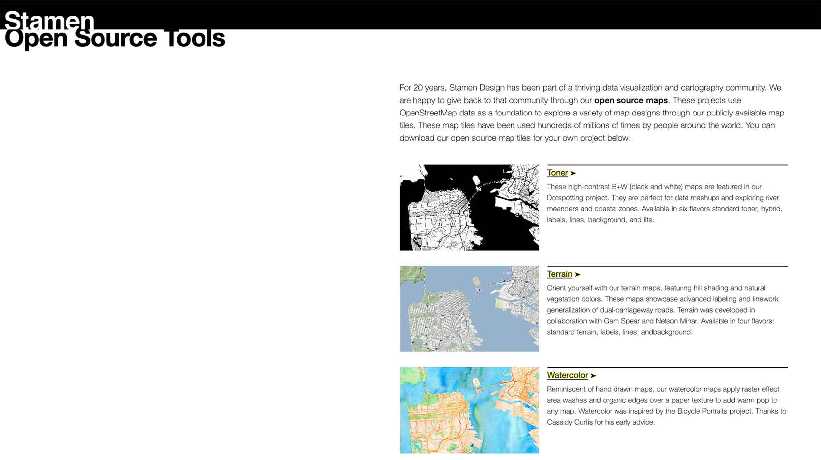
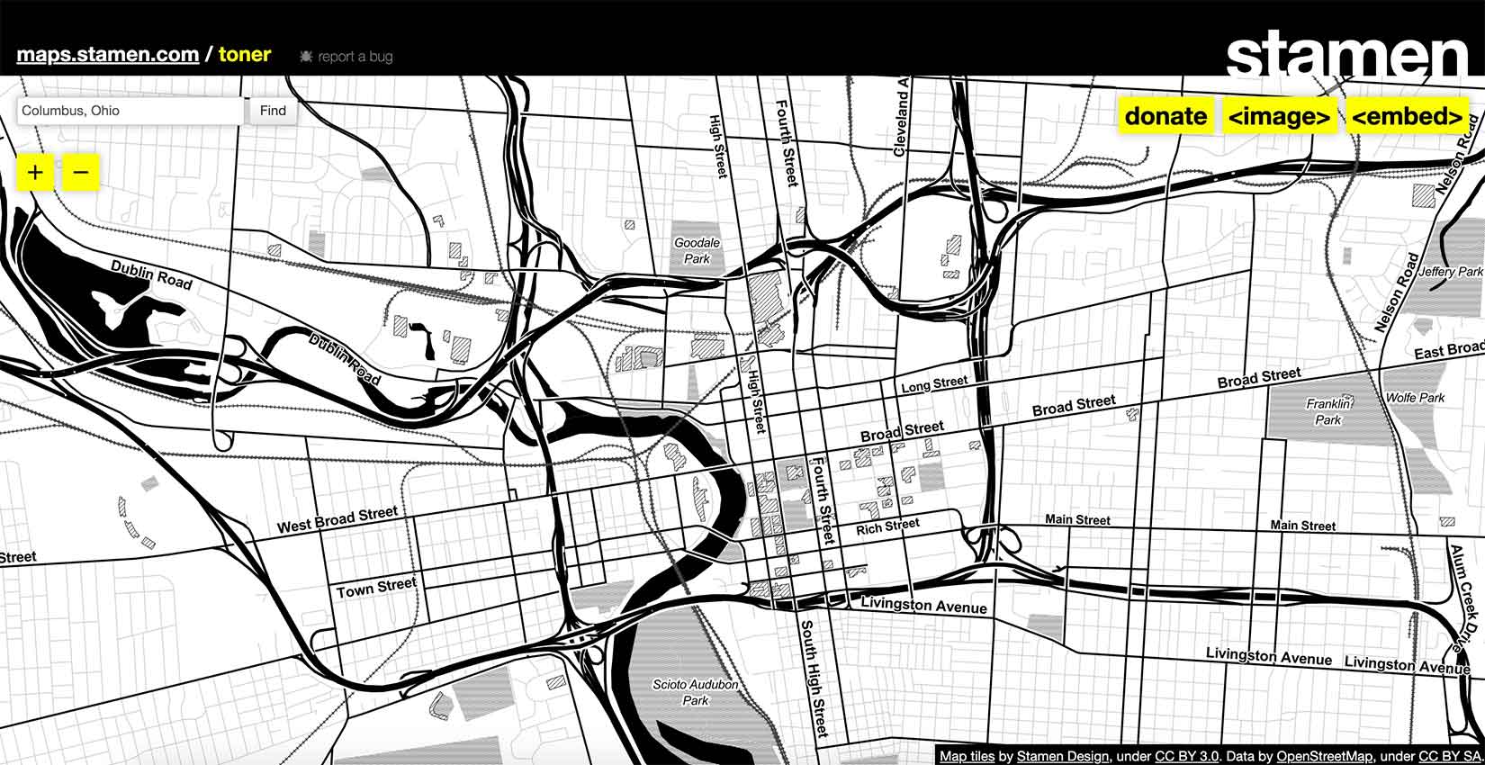
What if you don’t want to use a map but make a map? Stamen is a “data visualization and cartography design studio” that has worked for pretty much every major museum and Fortune 500 company. For the rest of us, they have made some great tools for downloading open-source maps for our own illustrations. First, choose among many different options, three of which you can see below:
Then, enter the place you want—and, yes, it has to be a real place. This is Columbus, Ohio, my own hometown, and the origin of my next heroine, Dr. Elizabeth Shepherd.
Click on <image> and you are given options for downloading a portion of the map. Check out the watercolor base for my Sugar Sun series map of Bais:
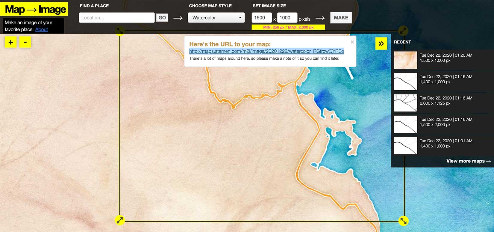
Amazing, right? It’s actually even prettier in the download.

Another amazing map resource that pulls from open source data is City Roads. Better still, you can download maps from this site as .svg files to reformat and reuse in your own illustrations.
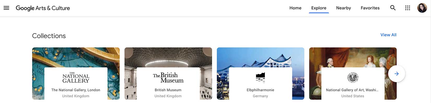
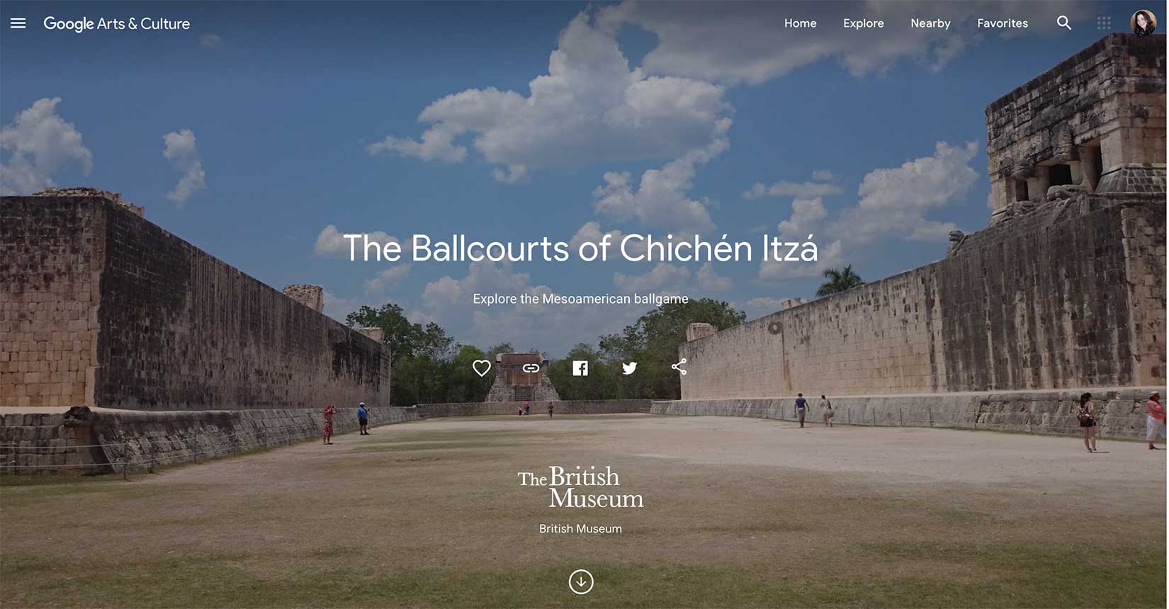
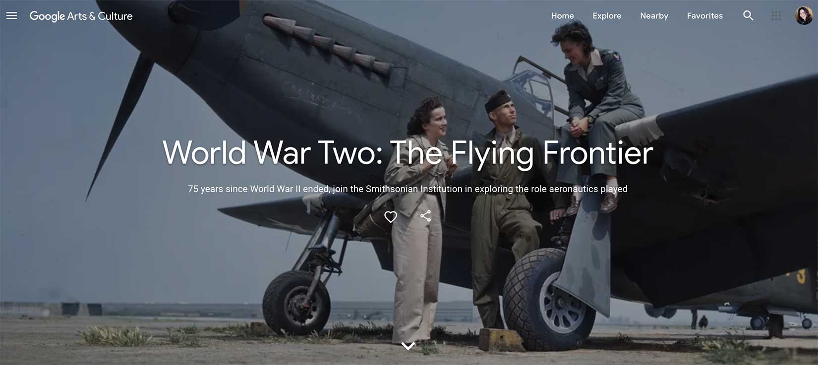
 Do you want to disappear down a museum rabbit hole? Google’s got that. They have digitized collections from over 100 global museums and cultural sites, particularly useful for the budget (or pandemic) constrained.
While nothing here can be downloaded, obviously screen grabs work pretty well.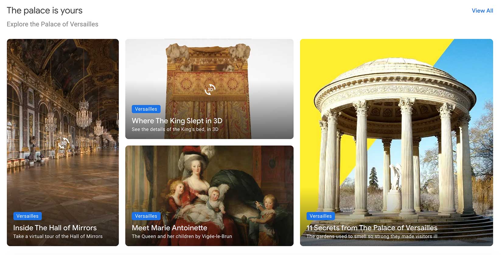
I particularly appreciate Google’s work with non-profit and academic institutions to bring ancient sites to life. I plan to use these in my teaching.
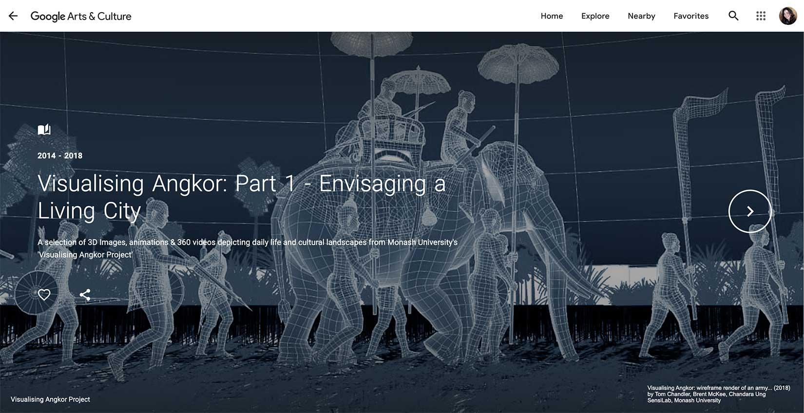
And, of course, they have both world wars pretty much covered:
I have just scratched the surface here. Go lose yourself.

One of the most important aspects of setting is what flowers you smell or what animals you see crossing the road. Whether flora or fauna, the GBIF database is incredibly powerful. If you know the species name of what you want, this site will show you where and when it has been sampled or observed. It will also give you a lot of data that I cannot really explain what to do with, but maybe you will figure it out. (The lack of science in my post-secondary education is obvious.)
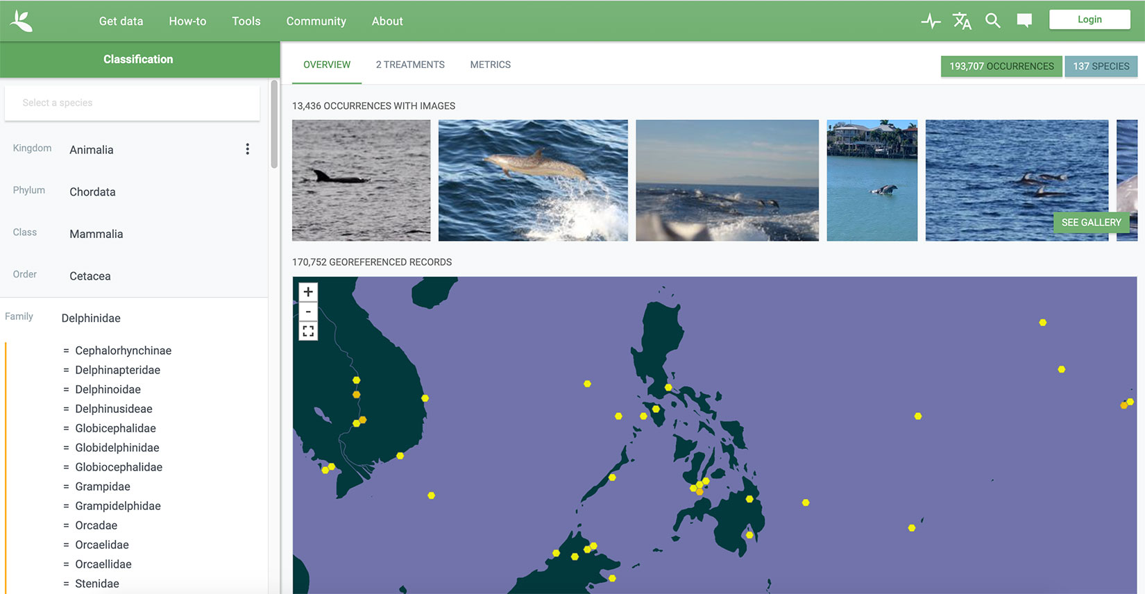
In order to find the record of any particular specimen, you cannot just click on the dot, which is not the greatest user interface. But if you use the limit tool underneath the zoom out button, you can find the information you want.
If you are just looking for plants, Plants of the World Online is another excellent metasearch engine.
Because my character Liddy is a fern fanatic, I have been using a few fern sites, like Ferns and Lycophytes of the World and the Pteridophyte Collections Consortium. But the first site above, GBIF, is a one-stop-shop, and I wish I had found it earlier.
 There is one other important type of map, and there is only one person making them: sensory maps. You got it: what does your scene smell like?
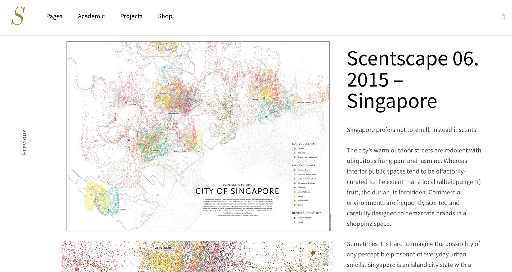
You can read more about artist Kate McLean and her project on Atlas Obscura. If you want the maps themselves, you have to go to her own website, SensoryMaps.com. There you can find illustrations that ask questions like, “What did ancient Rome smell like?”
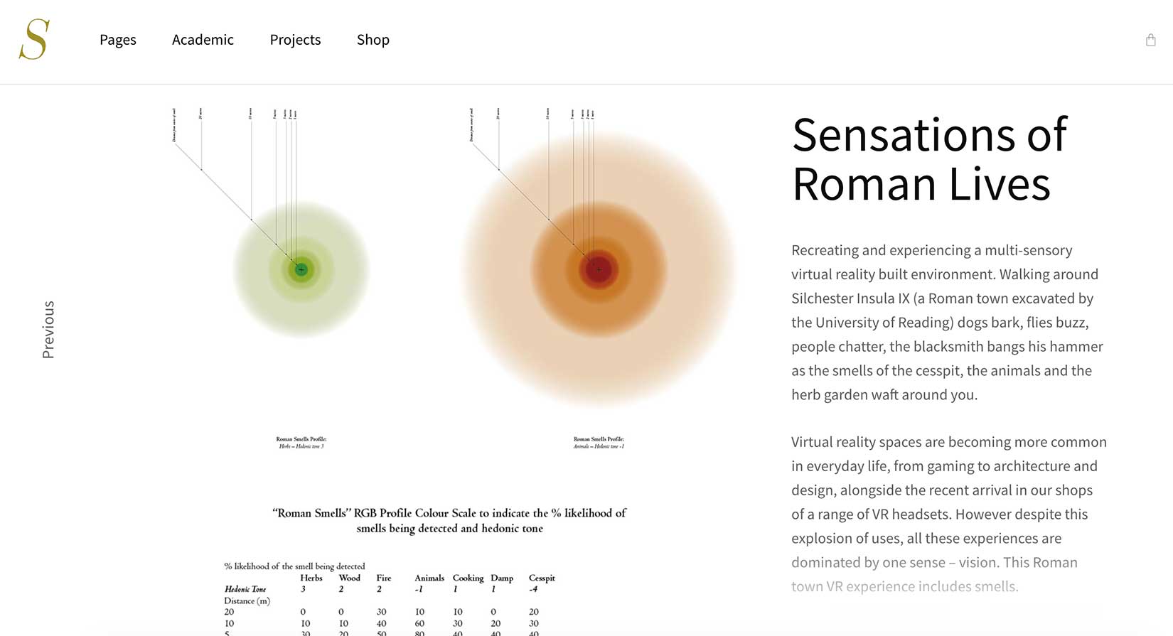
Smell is the sense too often forgotten in writing. See if Kate McLean can help you fix that.
Thank you for checking out this blog post. I hope the tools I have found are helpful to you, and feel free to contact me if you have other suggestions. Thank you for visiting!