Sugar Sun series location #10: Fort Santiago

Manila-map-1902

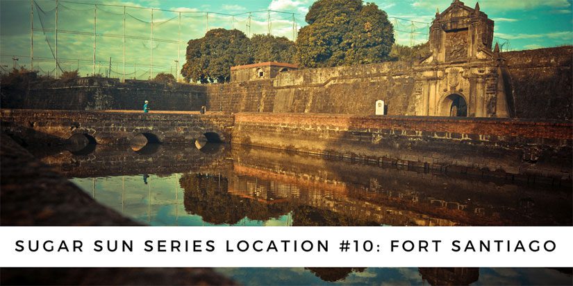
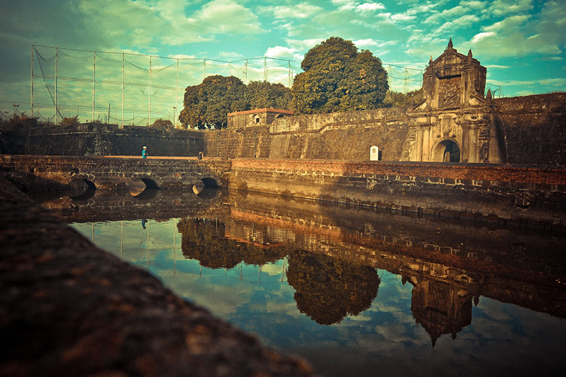
Georgina looked up at Fort Santiago, the stone embodiment of Spanish paranoia that capped the fortress city of old Manila. A bas-relief of Saint James the Moor-Slayer stood guard over the gate. Not the most observant Catholic, Georgie liked the thought of Iberian explorers braving the long, lonely journey across the Pacific only to find themselves back where they started: fighting Muslims. Judging by the number of churches they left behind, conversion had been a spiritual test they had met with gusto.

Under the Sugar Sun

Front gate of Intramuros with Saint James the Moorslayer
Saint James the Moorslayer, a close up of the main gate to Fort Santiago. Creative Commons photo by John Tewell.

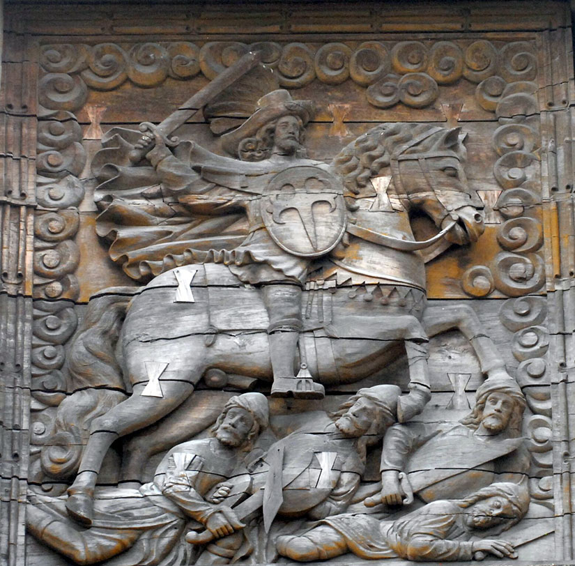
The defensive embankment of Fort Santiago (“Saint James”) has been around since shortly after the Spanish took Manila from its indigenous Muslim rajahs in 1571—hence, the tone-deaf dedication to Saint James the Moorslayer. (The Spanish converted or chased out most Muslims in the archipelago, but not all. Still today, 5% of Filipinos are Muslim, mostly in southern Mindanao and the surrounding islands.)

1665 view of Maynila from the bay
A bird’s eye view of Manila by Johannes Vingboons, painted in 1665.

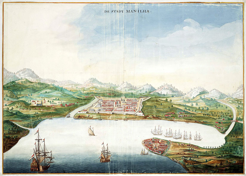
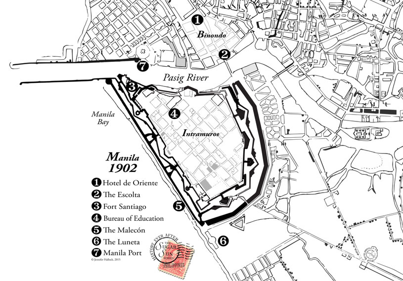
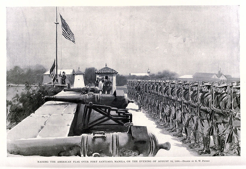
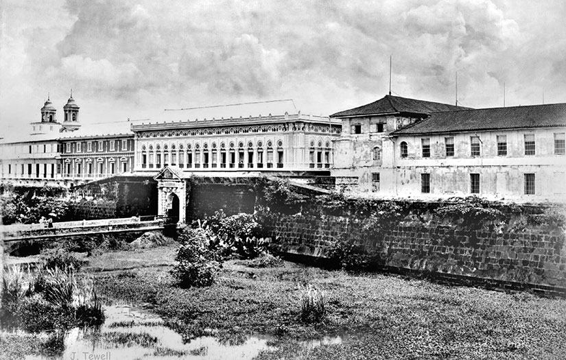
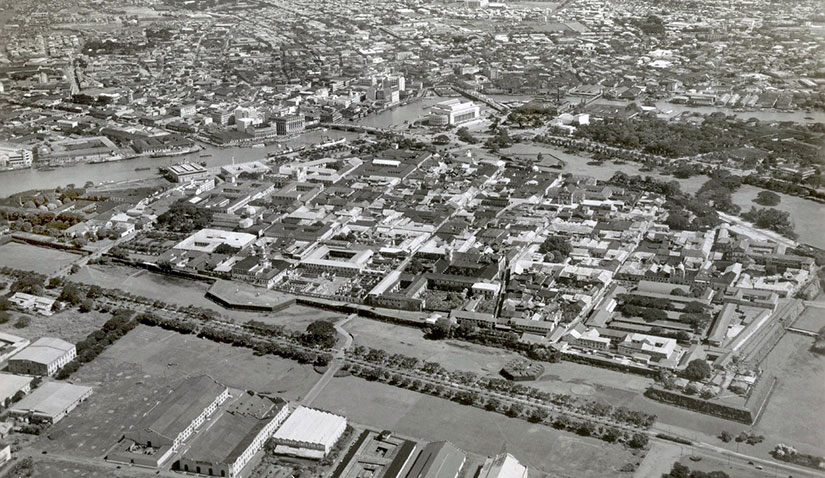
When a Dutch traveler painted Manila in 1665, you can already see the walled city of Intramuros, capped by Fort Santiago at the mouth of the Pasig River. This was where the Spanish Army was headquartered, and it will be the Americans’ choice, too. Almost 240 years later, my heroine Georgina Potter had no choice but to search for her missing soldier brother at Fort Santiago. (The relatively brief US stewardship may be the only time this citadel was not a fortress of Catholicism.)

American flag illustration over Fort Santiago after Battle of Manila 1898
Raising the American flag over Fort Santiago, Manila, on the evening of August 13, 1898. From Harper’s Pictorial History of the War with Spain, Vol. II, published by Harper and Brothers in 1899.

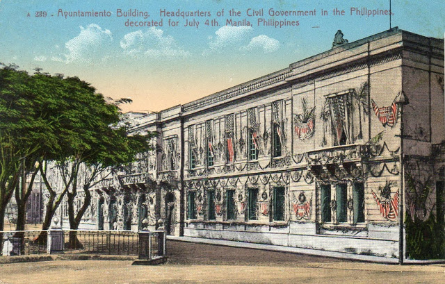
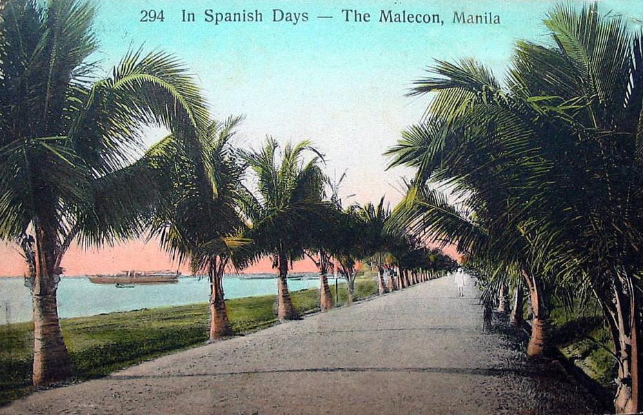
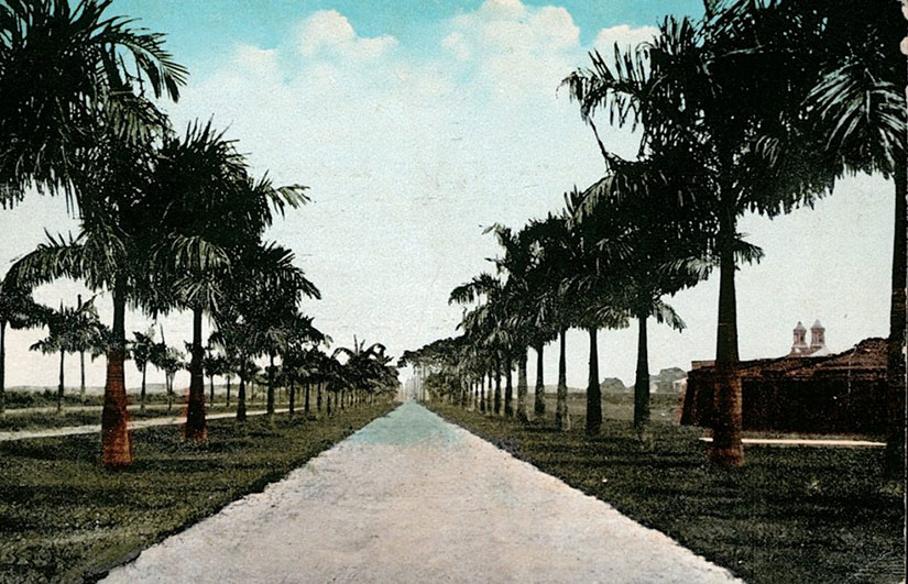
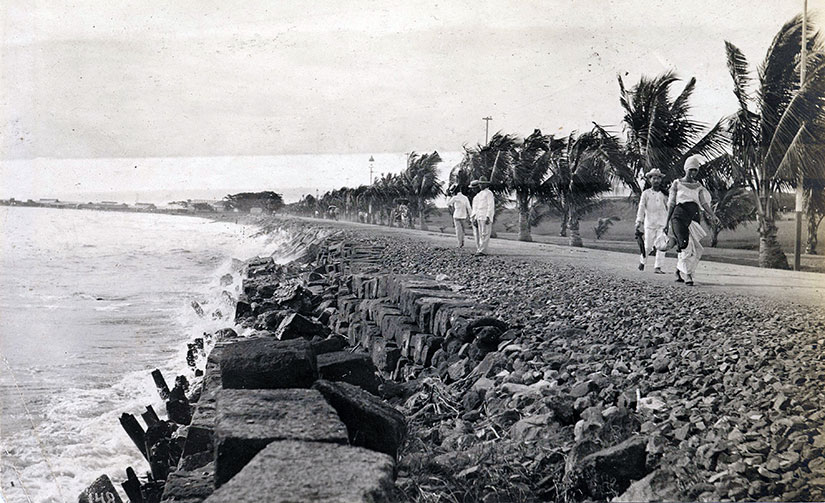
Through the eighteenth and nineteenth centuries, Manila grew into a thriving commercial and cosmopolitan center.

Vintage postcard of Fort Santiago mouth of Pasig River
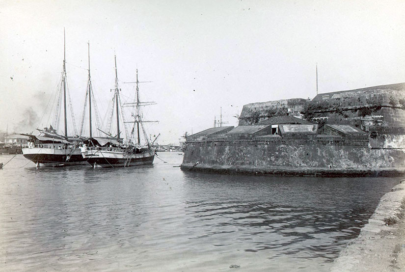
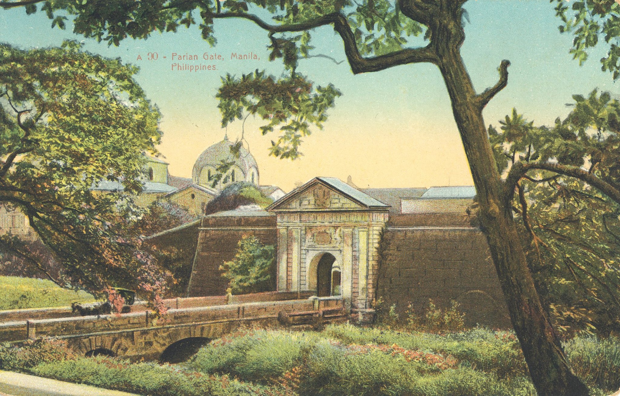
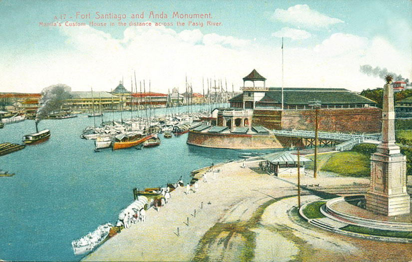
Every vessel that entered the city—from local casco to Manila galleon—had to sail past the intimidating cannons of Fort Santiago to reach the docks on the north side of the river.

Photo of boats in front of Fort Santiago
Walls of the old city of Manila. Fort Santiago with gorletas anchored in front of it, 1898. Photo from the Philippine Photographs Digital Archive.

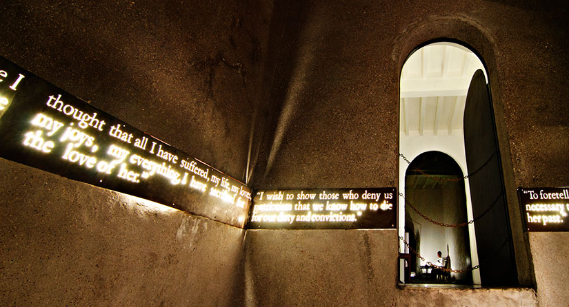
Importantly for Filipino history, Fort Santiago is also where national hero José Rizal spent his last days. In his spare time, this polyglot ophthalmologist authored the seminal work of Philippine fiction, Noli Me Tangere (Touch Me Not). The Noli blasts the corruption of the Spanish friars who ruled the countryside and reveals how young, intelligent Filipinos (like Rizal) were denied human and political rights. Since Rizal was executed for writing a work of fiction, the Spanish ironically proved his claims true.

Collection of last days of Rizal images
National hero José Rizal was held by the Spanish at Fort Santiago until his execution at the Luneta in 1896, sparking the Philippine Revolution. Images from left to right: the entrance to Rizal’s prison, as photographed by Barbara Jane; a common portrait of Rizal; and the map from the Presidential Library and Museum.

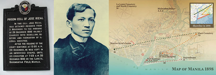
Rizal may have had revolutionary sentiments—how revolutionary is hotly debated—but his fate was ultimately sealed by priests, not politicians. Of course, these friars thought they were the government of the Philippines, so a challenge to them was a challenge to Spanish rule. Where did the friars put him? In their fortress of Saint James, of course. Rizal wrote these last words in his jailhouse poem, later named Mi Ultimo Adios:

My idolized Country, for whom I most gravely pine,
Dear Philippines, to my last goodbye, oh, harken
There I leave all: my parents, loves of mine,
I’ll go where there are no slaves, tyrants or hangmen
Where faith does not kill and where God alone does reign.

Jose Rizal's cell in Fort Santiago, pictured now
Jose Rizal wrote his farewell letter, Mi Ultimo Adios, while being held in a prison cell in Fort Santiago. Now the cell has been converted as the Rizal Shrine where a life-size diorama of his last hours is depicted before his execution. Creative Commons photo by Christian Sangoyo.

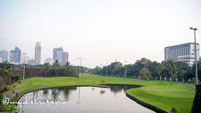
Scratch a stone in Manila and you’ll dig up all kinds of interesting history, right? By the way, the Creative Commons image below is by Fechi Fajardo. If you’re wondering what that net is, it’s a practice driving range for the Intramuros golf course! Oh, what would Rizal think?

Fort Santiago stylized modern

Sugar Sun series location #9: Intramuros

In the opening chapter of Hotel Oriente, heroine Della Berget describes Manila’s Intramuros as “an old Spanish walled enclave in the style of Gibraltar, plunked down in the middle of the tropics.”

Manila-map-1902

And, in fact, that is exactly what the city’s name means: inside the walls that the Spanish built (and rebuilt and rebuilt) to protect them from those who lived outside, the Filipinos and the Chinese. Capping off the walled city was the armed citadel of Fort Santiago:

Vintage postcard of Fort Santiago mouth of Pasig River

The Spanish did leave their walls on occasion. They had to if they wanted to do anything commercial. They shopped extramuros in Binondo, Manila’s Chinatown, which was within a cannon’s shot of Fort Santiago in Intramuros. The range was very intentional, by the way. The Spanish had a love-hate relationship with their Chinese immigrant neighbors, who, in many cases, had been in Manila longer than they had. Sometimes the “hate” end of things meant firing volleys. The love-hate relationship also played out in shopping, especially on a street called the Escolta. The Spanish claimed the Escolta exclusively for European merchants, but some of those merchants were supplied by Chinese in the neighboring streets. After a full day of shopping in Escolta and a lovely evening on the Luneta, the Spanish would retreat within their walls to sleep.

Manila Cathedral vintage postcard in color

What was inside the walls? Della calls it a “Catholic wonderland”: “If she glanced up, the city was all domes, crosses, and oyster shell windows.” And no wonder: there were seven churches in Intramuros before World War II. Seven churches—grand ones, too—in a space of a mere 1/4 square mile (166 acres). It should be no surprise to you, then, if I point out that it was really the Catholic Church, via the regular orders of friars, who controlled the Philippines. This was a Crown colony in name only. The real administrators? The Dominicans, the Franciscans, the Recollects, the Augustinians, the Vincentians, the Jesuits, and more. And Intramuros was the seat of their power, where the Manila Cathedral (above) towered over the secular offices of the governor and loomed over the general’s desk in Fort Santiago.

Ayuntamiento or the Palace vintage postcard
The Ayuntamiento (City Hall, or “Palace” as the Americans misleadingly called it) was the headquarters of the civil government of the American Philippines.

When the Americans came, they used the necessary parts of Intramuros, especially Fort Santiago and the city hall (which they confusingly mislabeled the Palace, even though the governor’s—and now president’s—residence is not inside the walls).

The Parian Gate into Intramuros, Manila, Philippines. You can see the clogged moat was a health hazard.

Actually, the Americans preferred a fresh sea breeze to the cloistered staleness of Intramuros, and they began to build up the areas south of the Luneta, including Malate and Ermita (where the US embassy compound still sits).

Puerta de Santa Lucia Gate into Intramuros, Manila, Philippines, 1899. This is before the Americans filled in the moat, as it shows here it was clogged with sediment. San Ignacio Church on the left, and San Agustin Monastery is behind the wall. Public domain photo from the John Tewell</> collection.

And, in their port expansion, they would create a whole “New Luneta” in what had previously been the Bay, and this is where they would build new social establishments, including the Manila Hotel and the Army and Navy Club. After this, many Americans had few reasons to enter Intramuros at all. Too bad.

Pre-war Intramuros from Wikimedia Commons.

Nor did the Americans like the medieval air (really, stench) of the moat surrounding Intramuros. In classic American form, they turned it into a golf course.

Intramuros Golf Club photo used under Creative Commons license by Marc Gerard Del Rosario. You can see that water still exists, but as manicured ponds to trap your golf balls.

Yes, this hardly sounds very populist, but the colonial administration was not inclusive—and, to be fair, the short but challenging par-66, 18-hole course is now owned by the government and can be played by anyone for around $20 (residents) or $30 (tourists).

aerial photo of Manila destruction in World War II
This original US Army Signal Corps photograph is in the personal collection of John Tewell. Notice San Agustin Church on the top right hand corner, the only of Intramuros’s seven churches to survive somewhat intact due to the red cross on the roof. This and the Manila Cathedral are the only two (of the original seven) to remain operating Catholic churches to the present day.

Intramuros suffered most at the end of World War II, when it was the site of the last stand between the occupying Japanese and liberating American forces. The Japanese unleashed a reign of terror on the occupants of Intramuros and Manila at large, known as the Rape of Manila. The Americans, seeking to force a surrender, bombed the city into oblivion, destroying 6 of the 7 churches in Intramuros. In fact, Intramuros was such a disaster that it was ignored during the post-war rebuilding phase and has only recently started to see a renaissance of cultural, social, and commercial activities. If you are in Manila, take a tour with performance artist Carlos Celdran, and he will make you see Intramuros in a whole new light.

Intramuros Manila location in steamy historical romance Sugar Sun series by author Jennifer Hallock. Serious history. Serious sex. Happily ever after.
The Transitio commemoration with Carlos Celdran: burning prayers on the walls of Intramuros (left) and the arts festival on the grounds (right).

Sugar Sun series location #8: Malecón

One thing that hasn’t changed in Manila since 1900 is the traffic. One anonymous visitor said about the end of the evening on the Luneta:

…there is a crack of the whip and a grand hurrah and one mad dash for the different homes. I wonder there are not dozen smash ups each afternoon, but there are not. I used to melt and close my eyes, expecting to be dashed into eternity any moment, but I have learned to like it, and I don’t want any one to pass me on the road.

We’ve all been there.

A vintage postcard of the Malecón.

Some park goers did not wait for the end of the evening to race, though. With the old shoreline, the water went right up to the walls of Fort Santiago—or almost. There was a single open road there, called the Malecón, where carriages practically flew:

The two vehicles ate up the open road. Georgie did not consider herself a coward, but she was torn between fearing for the horses’ safety and for her own. Maybe sensing that, Javier put his arm around her shoulders, pulling her closer to his side. It was too cozy by half, but it steadied her enough to make the frenetic motion bearable.

The two nags kept changing the lead. One would break out in a small burst of speed, and then slow in recovery while the other made his move. They had at least a mile to go until the “finish” at Fort Santiago, and it seemed that Georgie’s original prediction was on the mark: the sole surviving animal would win. It was less a race than a gladiatorial bout.

Under the Sugar Sun

Malecon-post-card
The Malecon Drive ran parallel to the Manila Bay, opening at its southern end to the Luneta, early twentieth century. Photo courtesy of the White House Historical Association.

You can find Malecón at location 5 on the map below. (These maps of Manila and the Visayas, which you can find in Under the Sugar Sun, were a suggestion of a faithful reader, Priscilla Lockney. Awesome, right?! But when I tried to find maps from before the port expansion that changed the shoreline, it was a challenge. I ended up making my own from a rare Spanish map reprinted in the Harper’s Pictorial History of the War with Spain, Volume II. I was almost as proud of these as I was of finishing the book.)

Manila-map-1902

The Malecón ran from the Luneta along the bay, “under the yawning mouths of the old muzzle loaders” to Fort Santiago (see 3). It seems like a strange place for romance, but it was that, too. Maybe it was the electric lamp posts installed in 1893, part of a half a million peso city improvement project. Maybe it was the company:

Georgina looked up. This close, she could see honey-colored circles in Javier’s brown irises. They looked like rings on a tree. Did she see in them the same fire she felt, or was this a part of the show?

Gently Javier tilted her chin up, his lips now inches away. No one had ever tried to kiss her, not even Archie, whose amorous attentions had all been by pen. She thought about resisting, but that was all it was, a thought. Javier’s breath was clean. Only the smallest bite of scotch lingered from lunch. Given her past, Georgie had never believed alcohol could be an aphrodisiac, but on this man the crisp scent was provocative. He smelled of confidence and power, yet his lips looked surprisingly soft—

Under the Sugar Sun

Luneta driveway Malecón Manila photograph
“Luneta driveway” taken by a US soldier. Available from University of Michigan Philippine Photographs Digital Archive.