This is the home of Jennifer Hallock, author of the Sugar Sun series. Whether you are a long-time fan of the larger Altarejos clan or just learned about the series through the Romancing the Past anthology, this website offers history and extras for everyone.
For Readers
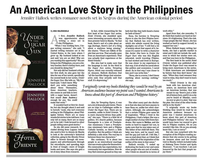
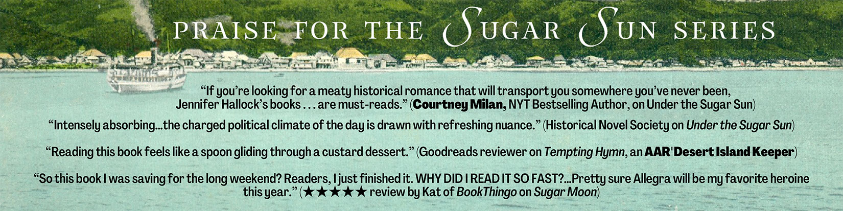
Learn all about the Sugar Sun series epic family saga set at the beginning of the twentieth century. Don’t know where to start? Check out this page. (And the short answer is anywhere: all are interconnected-yet-standalone happily-ever-afters!)A lovely Manila Bulletin article introducing the Sugar Sun series to the Philippine general reader. It was published on 6 March 2017. Thanks, Ana, for the story!On this guidance page, you can find book-by-book breakdowns, a short discussion of accuracy, and some general notes on heat level.Read what people are saying about the Sugar Sun series!Sign up for the Sugar Sun series newsletter. Don’t miss a sale or new release! Sent quarterly, mostly.I have written a lot of history on this blog—no surprise since it is my day job. Here are links to the most relevant posts, complete with illustrations.Want to learn more about the setting of the Sugar Sun series? Click on any of the graphics of this page, or explore the maps of the Philippines & Manila at the bottom of the post.Here is an alphabetical listing of the Sugar Sun glossary terms. Simply click on the graphic of your choice to open the annotated post in a new window. This list will be updated to include new terms as their posts are written.
For Writers
I have collected a slew of tools that I use regularly to enhance my character and setting development. This includes everything from how different height characters would look kissing to what the sky above them would really look like at night. I did not program these tools, but I have gathered them in one place for you.I was honored to be able to present my research and ideas about the fabricated historical chronotopes in romance genre fiction at the 2018 IASPR conference in Sydney, Australia. Part one looks at how the bestsellers in historical romance are disproportionately: (1) set in Great Britain; (2) overpopulated with nobles; and (3) selective in their historical accuracy.Part two looks at how the aggregate impact of these chronotopes can be harmful to our understanding of history, to the romance market as a whole, and particularly to authors of diverse books.Who likes to read about average? No one! We want to read about the outliers, the dangerous, the obscure, the interesting! Part of what authors are selling is the chance to live someone else’s life for a little while. Read about how micro-history can help authors offer exactly that.
If there is something you are looking for that is not covered by one of these banners, please use the search box to the left to find it. You can also find several ways to contact me. Thank you for reading, and here’s wishing you a History Ever After!
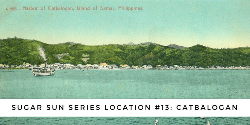
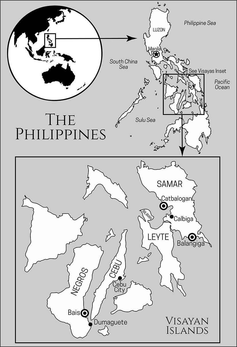
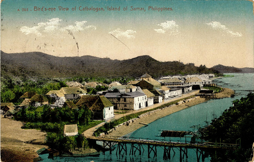
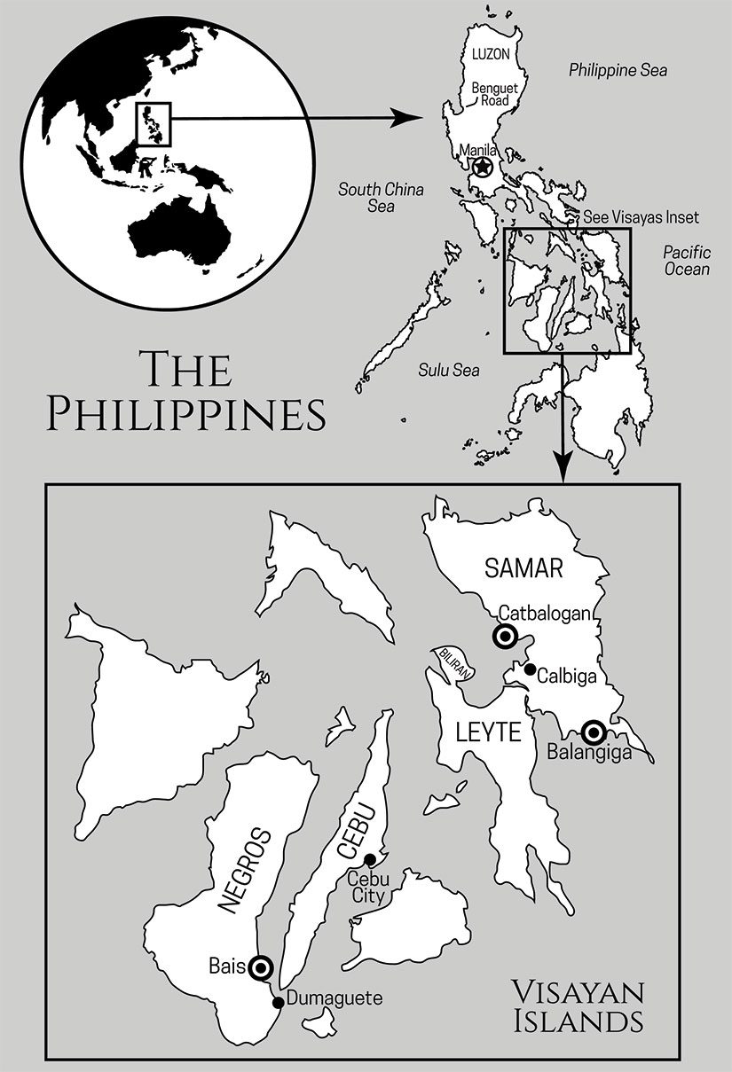
Catbalogan means “an everlasting place of safety,” and for hundreds of years it was safe—for pirates. The sheltered bayside harbor lies just north of the San Juanico Strait between Samar and Leyte, a key access point to the Pacific Ocean and the primary shipping route for the Spanish galleons. Since these vessels were headed to Manila with silver and then back to Acapulco with a hold full of porcelain and spices, they were ripe targets for pirates, right? And by “pirates” I mean the English and the Dutch privateers, who were licensed by their sovereigns to interdict and steal the Spanish bounty. Catbalogan became a haven for pirates and privateers, their crews, and lost sailors.
The southern mouth of the San Juanico Strait is right near Tacloban. Start there and follow the curve north and west into the bay above Leyte. The strait is 38 kilometers long and, at its narrowest point, 2 kilometers wide.
The Americans would find the city no easier to manage in the early twentieth century. For the first year of the Philippine-American War, the Yanks mostly ignored Samar because they had their hands full in Luzon. But then, in January 1900, gunships arrived offshore Catbalogan and sent a messenger to General Vicente Lukban, the Philippine revolutionary in charge of Samar and Leyte. The Americans wanted to negotiate a surrender of the whole island by offering Lukban the governorship of Samar. But Lukban wanted more than a title; he wanted full local autonomy. The Americans refused, so Lukban forbade them from landing. In turn, the Americans began to bombard the town. In other words, things escalated fast. Unable to withstand the US Navy’s firepower, Lukban and many of the locals abandoned Catbalogan, burning it as they retreated.
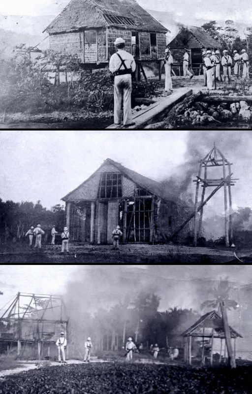
What followed was a ruthless two-year war to subdue the revolutionary forces in Samar. Company C of the Ninth Infantry was stationed to Balangiga to prevent Lukban’s men from using the southern port to import arms and supplies. On its own accord, the town ambushed the garrison in September 1901, and the American military took revenge on all of Samar. General Jacob Smith (known in the press as “Hell-Roaring Jake”) vowed to make the island a “howling wilderness.” Dusting off a legal gem from the American Civil War known as General Order 100, the Americans aimed to starve, burn out, torture, and kill as many guerrillas as possible. They even took the bells of Balangiga church. Catbalogan and Tacloban (Leyte) were the centers of American authority in this period.
USS Vicksburg sailors led by Lieutenant Henry V. Butler (later rear admiral) burning a village in Samar, October 1901. Photo courtesy of Arnaldo Dumindin and his excellent website on the Philippine-American War.
General Smith’s “short, severe war” was both. The death toll from this period ranges from two to fifteen thousand. The extremity of Smith’s orders—to kill all those capable of bearing arms, which he defined as over ten years old—would lead to his court-martial and removal. (Yes, I know this seems like a slap on the wrist, and it was. But President Roosevelt actually forced his retirement against army and public opinion, according to this New York Times article. In an interesting side note, this was Smith’s first court-martial: “Hell-roaring Jake” was a petty crook, as well as a blow-hard war criminal.)
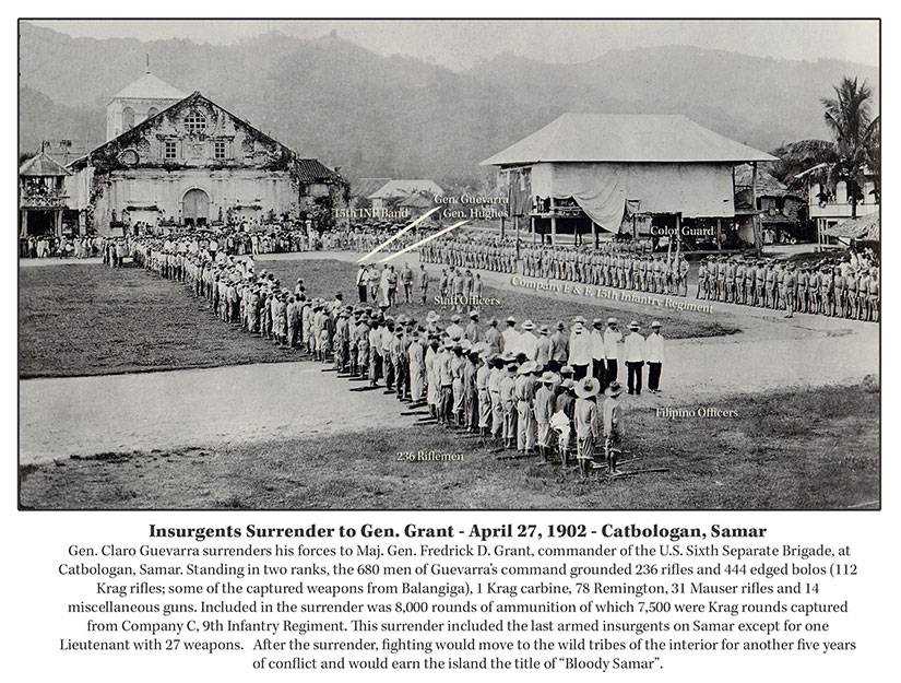
Still, contemporary American generals argued that a strong hand in Samar was necessary. They argued this strong hand was exactly the reason that Lukban’s forces surrendered in April 1902 in a grand ceremony in Catbalogan. (Lukban himself had already been captured.)
Those surrendering had to turn over their rifles captured from Balangiga the previous year and pledge loyalty to the United States, but then they were freed. Lukban himself would become mayor of the Tabayas province (now Quezon) within ten years. This begs the question of whether it was the severity of the fight or the quality of the peace that pacified the countryside? Amnesty is not used much in America’s modern war playbook, and I wonder if this is an oversight.
There is an interesting fashion note worth mentioning: the Americans did loan the revolutionaries a few Singer sewing machines so they could surrender in style with new (and complete) uniforms. Pride was salvaged all around.
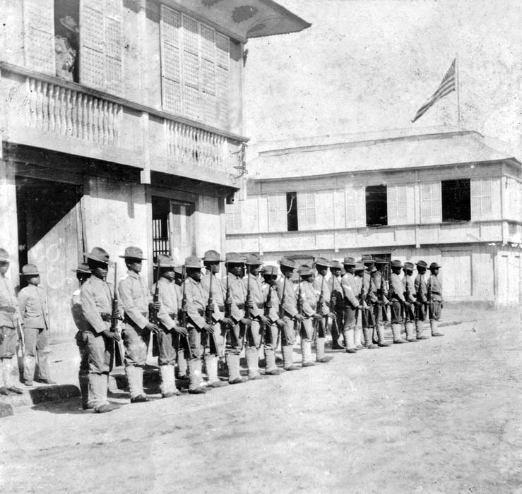
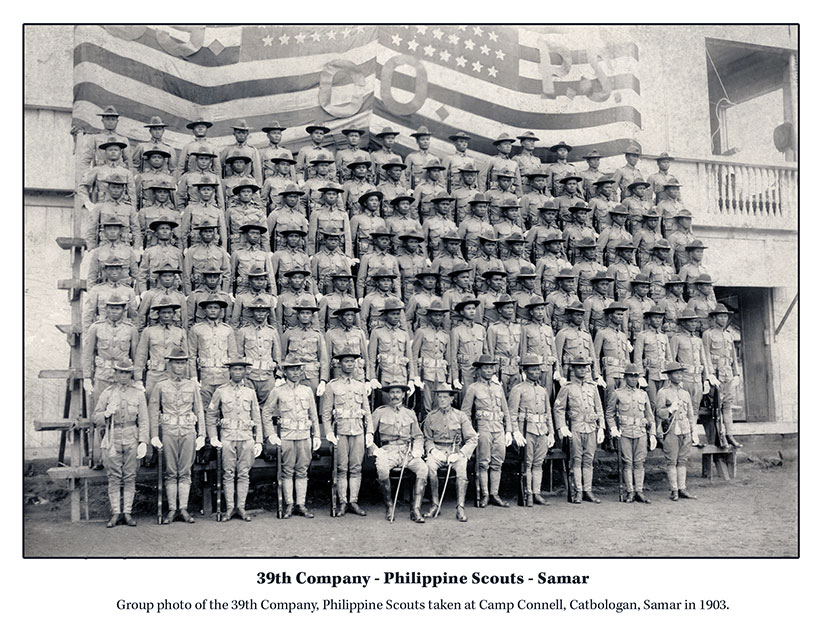
This is not the end of the story, though. This first war—including the destruction of half the municipalities in Samar and the burning of tens of thousands of tons of rice—caused a lingering famine and sparked another war two years later. Today, we call this phenomenon “blowback.” The Pulahan War was both a civil war (inland highlanders against lowland merchants and farmers) and an anti-American insurrection. On the American side, it was fought by the Philippine Constabulary, Third District—a civil police force organized, funded, equipped (not well), and trained by Americans (usually former soldiers). And by the 39th Philippine Scouts, trained and equipped (with better rifles) by the US Army. Both these units had significant troop presences in Catbalogan, along with the 6th, 12th, and 21st U.S. Infantries.
The 39th Company, Philippine Scouts, stands at present arms outside their barracks in Catbalogan, Samar. Both photos (above and below) courtesy of Scott Slaten of the Philippine-American War Facebook group.
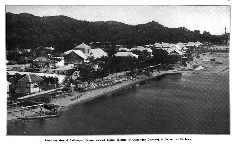
Catbalogan was a highly fortified town, but it was still beautiful. The ring of mountains separating it from the suffering of the rest of Samar did make for a stunning backdrop.
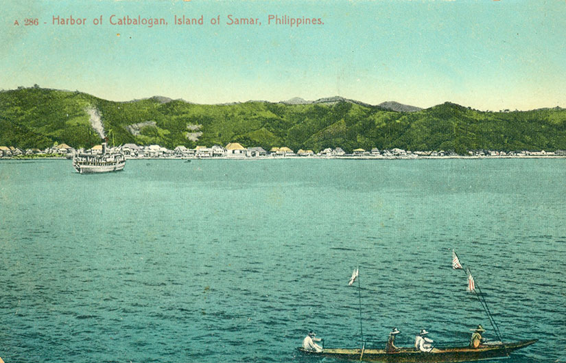
Colorized vintage postcard of a steamer coming into to dock at Catbalogan, Samar, Philippines. Scan courtesy of Scott Slaten of the Philippine-American War Facebook group.
The city fared better than the rest of Samar through the lean times. Though the galleons no longer journeyed back and forth to Spain, Catbalogan was a center of the abaca trade in the 19th and 20th centuries, hence the large buildings and church. Abaca, also called Manila hemp, was in high demand as naval cordage. Its trade was dominated by ethnic Chinese and British merchants, and once Samar was no longer in ashes, the fiber would revive and bring an influx of capital to Catbalogan.
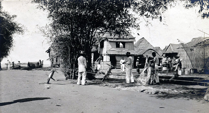
Filipinos making rope. This photograph shows the hemp as it comes from the leaves and is put on the spool for winding. Courtesy of the Philippine Photographs Digital Archive.Vintage postcard of Samar with a view of the wooden causeway connecting town to the port. Scanned image of the early 20th-century card by Leo D. Cloma.
In the early twentieth century, Americans complained about the lack of poultry, eggs, and fruit in Catbalogan. (I find the fruit claim hard to believe.) They also complained about the lack of dedicated school buildings—not one in the whole town—and the lack of teachers. (Whose fault is that?) And they complained that there were only five miles of road on the whole island. The Americans would build more.
I traveled to Samar in 2005—and while I would not recommend December for your trip because of the rain, I loved it. The island is just as breathtaking as the postcards from 100 years ago.
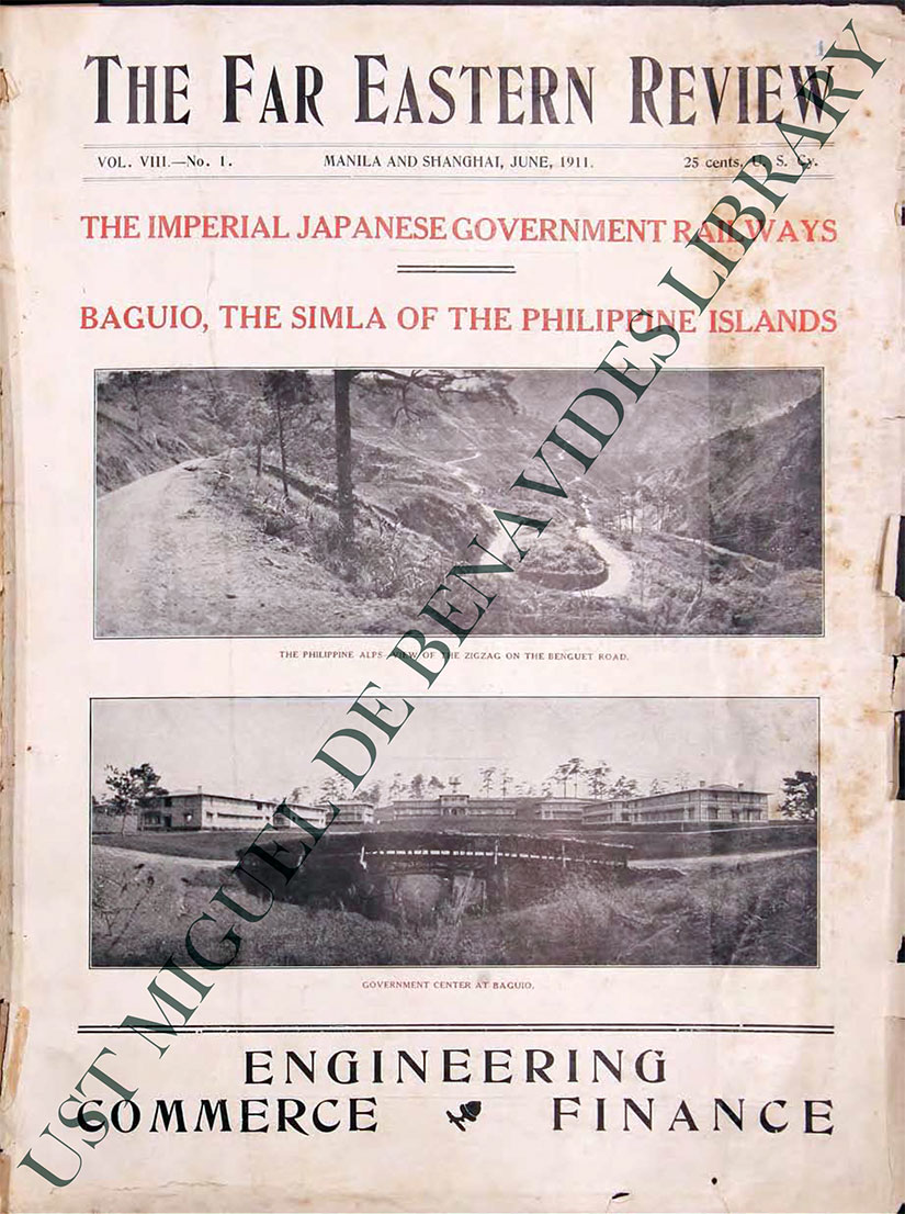
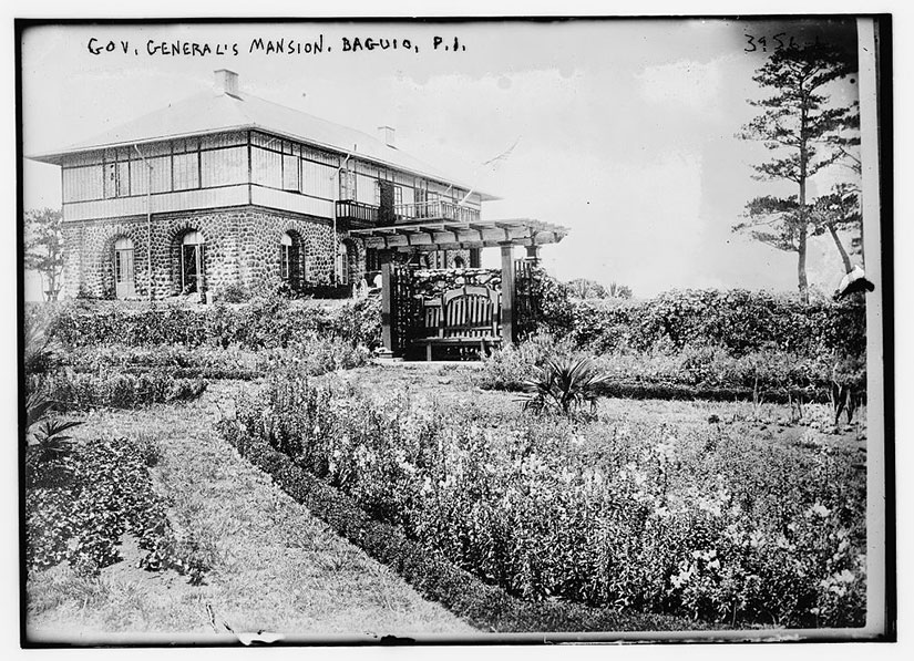
“Baguio, the Simla of the Philippine Islands,” touts the Far Eastern Review of June 1911. Image courtesy of the Miguel de Benavides Library of the University of Santo Tomas, in case you couldn’t tell by the way it was watermarked across the front.
The opening scenes of Channel 4’s Indian Summers shows British families making the journey up the foothills of the Himalayas to Shimla, the Crown’s summer capital. There they will relax in the temperate climate: “dance and forget,” as one Indian observer says. “A hotbed of political, social and romantic intrigue set amid rolling hills,” the Guardian wrote, “no place encapsulates the global ambitions as well as the parochial desires of the Raj better than Shimla.”
The Americans may have been late to the Great Game, but they would still have time to fashion their own Shimla in the Philippines. It was not until five years into American rule—on June 1, 1903—that the Philippine Commission officially designed Baguio as the Summer Capital of the Philippines. But the site had been chosen years before as a way to escape the heat of Manila:
There are hotter places than the lowlands of the Philippines—hotter places than Manila—but there is none where there is such a never-ending, boundless continuity of heat, day in and day out, week after week, month after month, throughout the whole cycle of the year—none so insidiously saps the vitality and relaxes the springs of energy native to men from colder climates.
Nestled in the Cordillera Mountain Range, this outpost offered “rolling, turf-covered hills, studded thick with fragrant pines, and swept by all the breezes.” The Americans now had a chance to create a town from scratch, one that represented everything they thought they were in the Philippines to provide: an orderly, beautiful center of transparent governance and intellectual inquiry. Yes, American colonial officials took their “City on a Hill” idealism seriously. The only problem was they did not have a way to get up the Hill. (Well, okay, that was not the only problem with their imperialist mentality, but it is the one we will deal with here.)
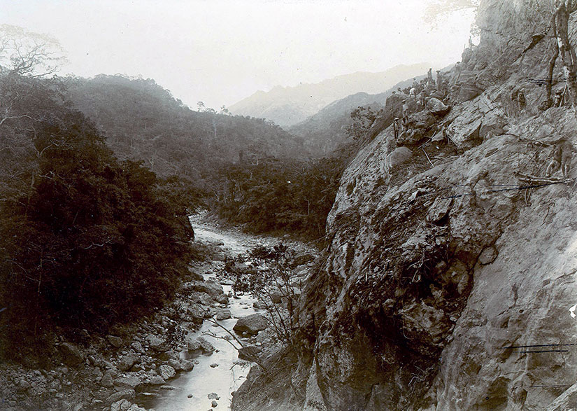
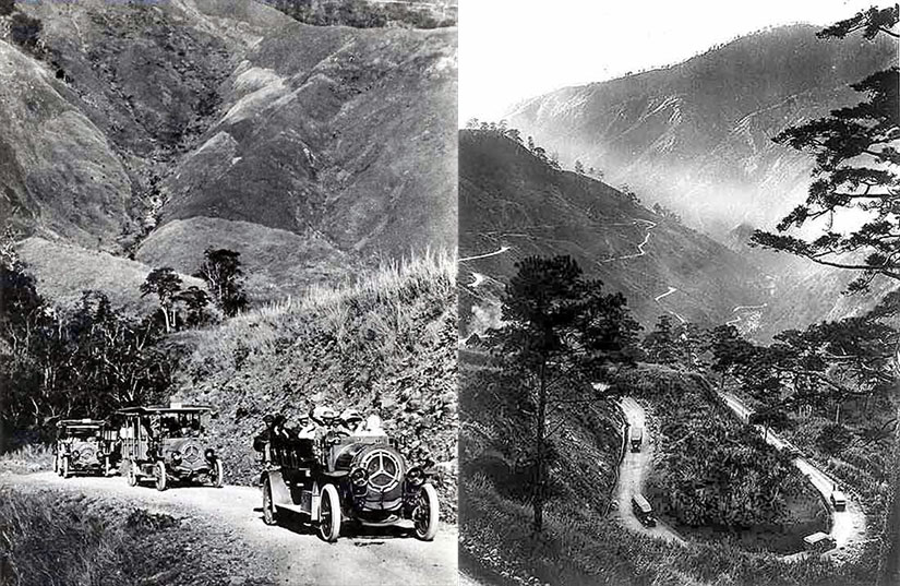
The Yanks envisioned a railroad up the mountainside to Baguio, but they had to settle for a wagon road along the Bued River Canyon. This “simple” trail cost enough to build that by 1906 there was no money left to build a railroad—or to fully develop the city of Baguio itself. And though it was just meant to be a temporary passage, Kennon Road (Route 56), named after the American engineer in charge of the project, still exists. It is the shortest route to Baguio, and one of the most dangerous roads in the Philippines.
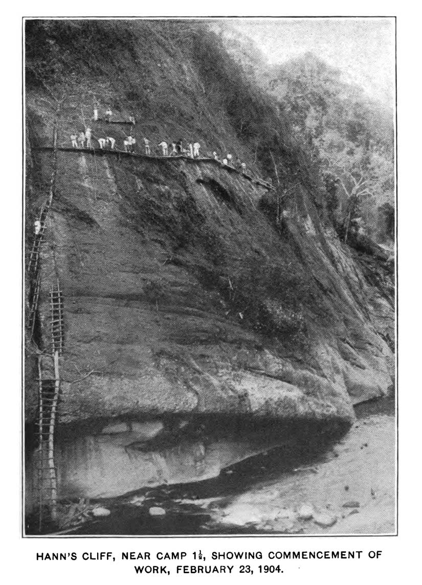
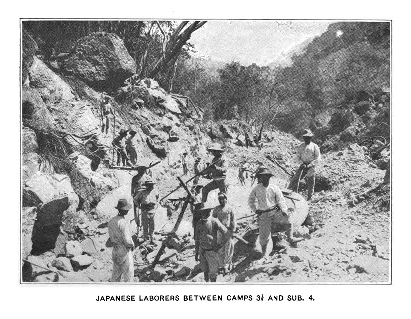
The danger is what made construction so expensive in the first place. Initial work began in January 1901 on a cliff above what would become Camp 1. Workers needed to first climb up to dangerous heights, then set dynamite charges, and finally get to safety before the charges blew. Some workers were a little reluctant to scale the cliffs in the first place, and they had to be shamed into it:
On reaching the 50-foot ladder, the men had categorically refused to ascend, proving equally deaf to threats or appeals, and had only done so after the disgusted foreman had ordered his wife to mount: “She did so and the whole party, following her, moved on its way.”
Quoted in Greg Bankoff’s “‘These Brothers of Ours’: Poblete’s Obreros and the Road to Baguio 1903-1905”
And if the working conditions did not kill you, the other workers might: “a timekeeper was attacked with bolos…and several horses were mutilated by the same means.” Having started construction in the midst of a fierce guerrilla war, recruitment was an even bigger challenge than cutting down cliffs.
The original workforce was made of impressed Igorot tribesmen, considered to be “a vastly superior animal” who could be trusted “without the necessity of a white foreman to watch him,” according to one of the American engineers. (Even when trying to pay compliments, the Yanks could not help but be paternalistic and racist.) The Americans disparaged the Spanish-style corvée method—after they had already used it to construct over 1,000 miles of roads in the islands—because they felt the need to “raise” the Filipino by offering “fair wages, training, and education.” (Despite their grand talk, they did also try convict labor. But shackled prisoners were not great choices for cliff work. Moreover, the men were a flight risk.)The result was initially almost no workers at all. By January 1903, at the time of the official designation of Baguio as the summer capital, there were only two to four men at work on the road each day. Something had to be done. The Americans started hiring whomever they could get: Native Americans, Hawaiians, Mexicans, Peruvians, Chileans, Indians, Chinese, Japanese, Russians, Germans, Irish, English, French, Swedes, Spaniards, and all the peoples of the northern Philippines, from Ilocanos to Visayans.
The most problematic were the Tagalogs, according to Kennon. But he really meant one particular Tagalog: a labor recruiter named Pascual Poblete. At the center of the Kennon-Poblete controversy is the American definition of what constitutes “fair wages.” Poblete had recruited hundreds of workers with talk of one to two dollars gold a day, as long as the Filipino did the same amount of work as an American laborer. This may have been a possible negotiation point, but the starting rate for Filipinos workers was twenty-five cents gold—a quarter to an eighth what these men had been led to expect, and an eighth of an unskilled American’s salary. When they got to Twin Peaks, they found out the truth about “fair wages.” And they walked out.
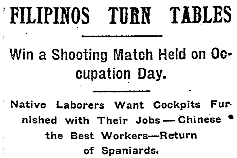
Though the Poblete worker walk-out was a cause célebre in Manila, it was only mentioned once in the New York Times. Note that despite the Times‘s claim that Chinese were the best workers, 500 to 1000 were let go for being “difficult to manage,” according to scholar Greg Bankoff.
As the disappointed laborers made their way home, they met other Poblete-recruited workers heading out to Benguet. These latter men heard tales of abuse and maltreatment by Americans—not all of which seems possible given the short tenure of their employ—and a crowd of angry workers flooded back to Manila to rally around their recruiter. Poblete, who also happened to own the nationalist newspaper, El Grito del Pueblo, wasted no time in embarrassing the new civil administration under Governor Taft. His most hated targets, though, were the Filipino collaborators in the Philippine Commission and the members of the Partido Federal who were advocating for US statehood. This labor event became a rallying cry for all those who saw the Americanistas as “los mismos perros con distintos collares,” or “the same dogs with different collars.”
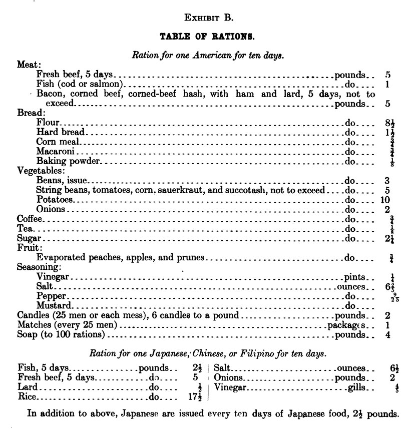
The men who stayed in camp to work were divided into three groups for bunking and eating: Americans (including all Europeans and Africans), “Orientals” (Chinese, Japanese, and Indians), and Natives (Filipinos). Americans were paid the most and ate the best:The Americans did try to help out their Filipino workers keep their “fair wages” by not allowing labor agents and patrons to siphon twenty percent off the top in kickbacks. Any foremen taking money from their crews in such an arrangement would be dismissed. One white foreman was sentenced to six months in Bilibid Prison for this kind of graft. Eventually, workers would be encouraged to bring their families up to the road as a way of keeping the men happy and tranquil. There were bands who played during work hours so the men could let “the dirt fly in time to the music.” And there were dances, saloons, and even a cockpit.
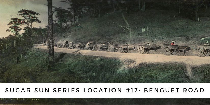
By October 1903, there were twenty thousand men at work on the Benguet Road, just under half of whom were Filipinos. A large number of these were folks from northern Luzon, particularly Ilocanos. Despite the full complement of workers, though, most experts predicted that it would still take at least three years to build the road. They did not count on Kennon’s eagerness to win a bet. Someone wagered him that the road would not be passable by January 1905, so on the 29th of that month, Major Kennon drove his calesa from Camp 4 into Baguio—along the most difficult and dangerous stretch of the route, a portion known as the Zig-Zag. Though the road was not quite finished, it would only take another year and a half Kennon handed it over to the Philippine Commission to administer in November 1906.
Traffic on the road was mostly mule teams and ox carts from 1906 to 1909, when Stanley Steamer cars were introduced. The next year, they brought in De Dion-Bouton petrol buses, with the world’s first 70 horsepower, 8-cylinder engines. A ride on these Benguet Auto Line buses was included in a railroad ticket from Manila, which cost P27 per person (about $365 in 2016 dollars) for a first-class fare, and P23 ($311 now) for second class.
That’s steep compared to the $15 bus fare today, but even a $300 ticket would not make up for the cost of building the road itself: P3,923,694. That equals $1.9 million in (gold) 1905 dollars, and $53 million in 2016 dollars. The cost breaks down to P147,895 per mile, or $2 million per mile in today’s terms. Before you call the road a boondoggle, though, know that $2 million a mile is about right for a new 2-lane undivided road in rural areas, according to the American Road and Transportation Builders Association. (Admittedly, they are talking about a paved road that is not regularly washed out by flooding, but who’s quibbling?)
Baguio lost its accreditation as summer capital in 1913, but that did not stop Americans from playing there. One regular use was by the Thomasite teachers, who developed a Vacation Assembly Camp. (Stay tuned for an upcoming post on that.) Moreover, the first Episcopal bishop of the Philippines, Charles Henry Brent, build his school for American children in Baguio, the first of what is today three international school branches, including Manila and Subic. Not only did I work in the Manila branch of Brent School, but the founder’s son of my current school worked at the original in Baguio. And, in my upcoming book, Sugar Moon, the story will begin with the Benguet road construction and end with Teacher’s Camp.
Once you get there, it’s beautiful. Just don’t look down.
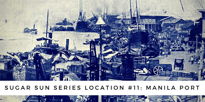
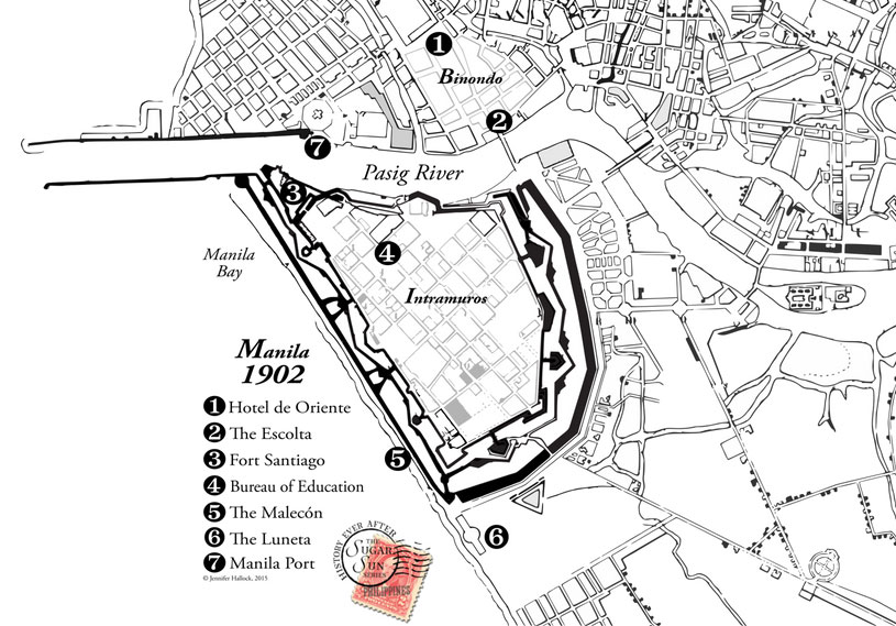
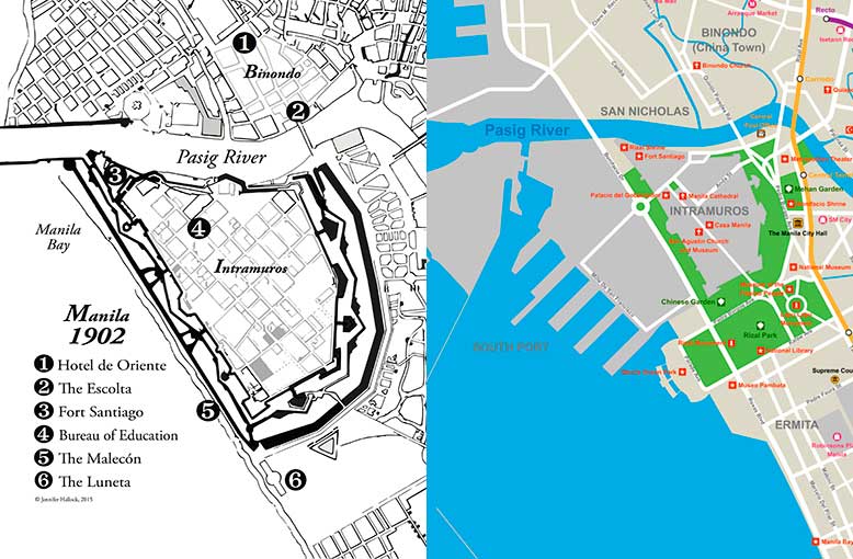
Have you heard romantic stories of evenings strolling on the Luneta, once upon a time? Or racing along the Malecón? Did you wonder where these entertainments took place? Maybe all you know is the enormous port that eats up Manila’s shoreline. If you look at the 1902 map above, though, you will see that port is not there. Not yet.
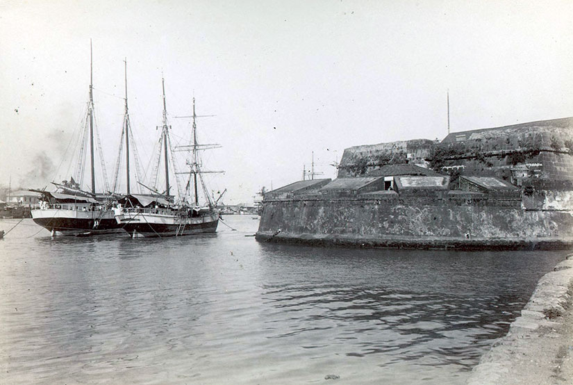
North shore of the Pasig River. Photograph in the public domain and archived with the University of Michigan, Philippine Photographs Digital Archive.
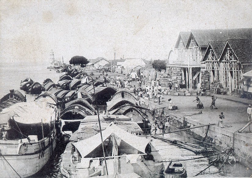
Before 1908, a visitor’s steamship would anchor two miles offshore in the rough seas of Manila Bay. The passenger would transfer to a lighter, known as a casco, and ride with their luggage into the city this way:
[Della’s boat] pulled past a large fort flying the American flag and headed into the mouth of the Pasig, a river as wide as the Potomac but ten times as crowded. Bossy American steamers, lighters heavy with food and livestock, outrigger fishing boats, and single-man canoes fought upstream for a space at the north-side dock. Her boat won a place and tied up in front of a huge warehouse marked Produce Depot.
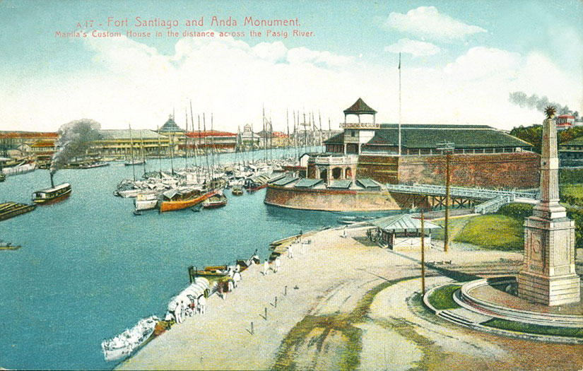
This original port was on the north shore of the Pasig: in front of the San Nicolas fire station and across the river from Fort Santiago. The Yankees did not like this lighter system, though, because they thought it was dangerous and inefficient. Something had to be done, they said. Hence, one of the first major infrastructure projects of the new century was born. (The other from this time was the Benguet Road to Baguio.)
Between 1903 and 1908, the Americans would add 200 acres to the shoreline through land reclamation. The breakwater was expanded, and numbered piers lined the bay.
It was supposed to cost $2.15 million, and certainly no more than $3 million, but—as with all infrastructure boondoggles—it ran to $4 million before the construction was over. (That is $108.4 million in 2016 dollars.) Compared to Boston’s $24.3 billion for the Big Dig (a highway and tunnel project), you still might say that Manila port was a bargain. But before you believe this an example of American largesse, remember that all expenses of the Philippine Commission were paid from local tax revenues.
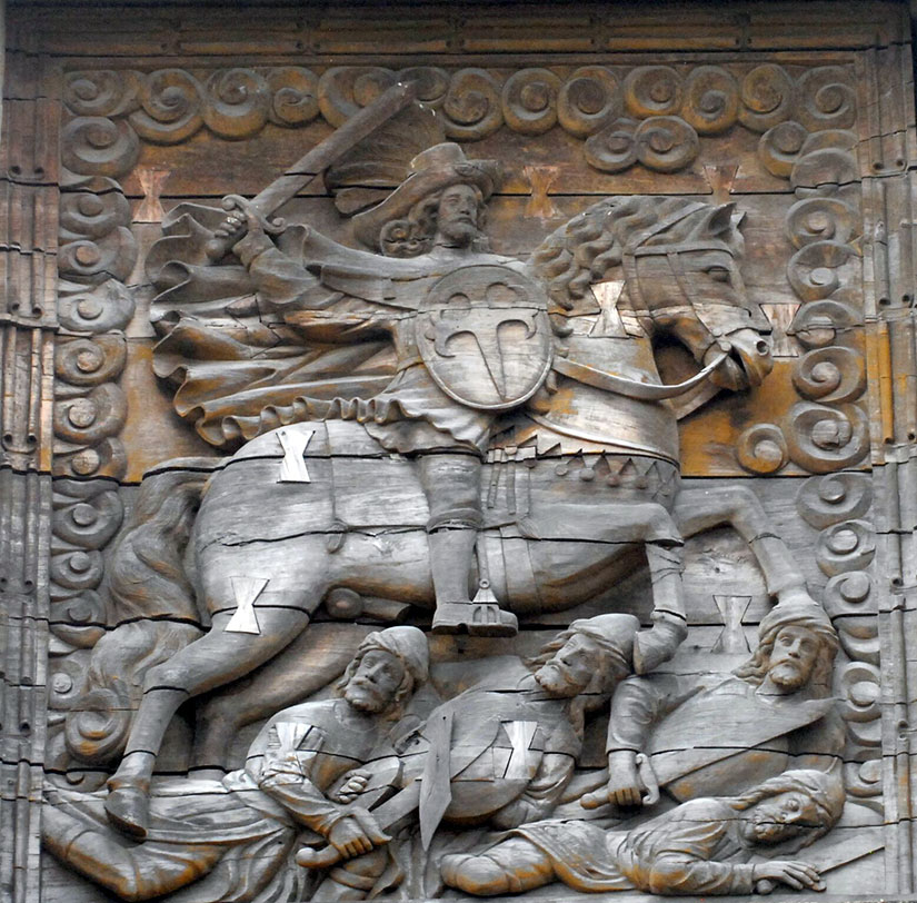
Georgina looked up at Fort Santiago, the stone embodiment of Spanish paranoia that capped the fortress city of old Manila. A bas-relief of Saint James the Moor-Slayer stood guard over the gate. Not the most observant Catholic, Georgie liked the thought of Iberian explorers braving the long, lonely journey across the Pacific only to find themselves back where they started: fighting Muslims. Judging by the number of churches they left behind, conversion had been a spiritual test they had met with gusto.
Saint James the Moorslayer, a close up of the main gate to Fort Santiago. Creative Commons photo by John Tewell.
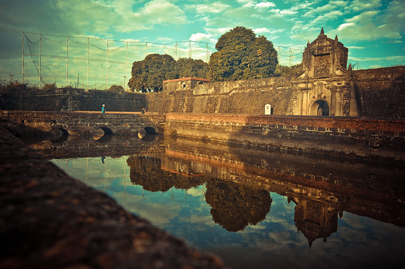
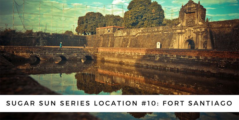
The defensive embankment of Fort Santiago (“Saint James”) has been around since shortly after the Spanish took Manila from its indigenous Muslim rajahs in 1571—hence, the tone-deaf dedication to Saint James the Moorslayer. (The Spanish converted or chased out most Muslims in the archipelago, but not all. Still today, 5% of Filipinos are Muslim, mostly in southern Mindanao and the surrounding islands.)
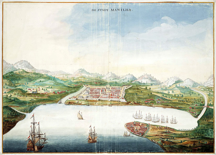
When a Dutch traveler painted Manila in 1665, you can already see the walled city of Intramuros, capped by Fort Santiago at the mouth of the Pasig River. This was where the Spanish Army was headquartered, and it will be the Americans’ choice, too. Almost 240 years later, my heroine Georgina Potter had no choice but to search for her missing soldier brother at Fort Santiago. (The relatively brief US stewardship may be the only time this citadel was not a fortress of Catholicism.)
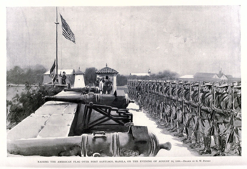
Raising the American flag over Fort Santiago, Manila, on the evening of August 13, 1898. From Harper’s Pictorial History of the War with Spain, Vol. II, published by Harper and Brothers in 1899.
Through the eighteenth and nineteenth centuries, Manila grew into a thriving commercial and cosmopolitan center.
Every vessel that entered the city—from local casco to Manila galleon—had to sail past the intimidating cannons of Fort Santiago to reach the docks on the north side of the river.
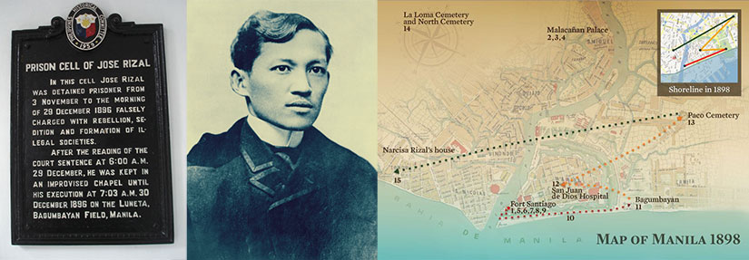
Importantly for Filipino history, Fort Santiago is also where national hero José Rizal spent his last days. In his spare time, this polyglot ophthalmologist authored the seminal work of Philippine fiction, Noli Me Tangere (Touch Me Not). The Noli blasts the corruption of the Spanish friars who ruled the countryside and reveals how young, intelligent Filipinos (like Rizal) were denied human and political rights. Since Rizal was executed for writing a work of fiction, the Spanish ironically proved his claims true.
National hero José Rizal was held by the Spanish at Fort Santiago until his execution at the Luneta in 1896, sparking the Philippine Revolution. Images from left to right: the entrance to Rizal’s prison, as photographed by Barbara Jane; a common portrait of Rizal; and the map from the Presidential Library and Museum.
Rizal may have had revolutionary sentiments—how revolutionary is hotly debated—but his fate was ultimately sealed by priests, not politicians. Of course, these friars thought they were the government of the Philippines, so a challenge to them was a challenge to Spanish rule. Where did the friars put him? In their fortress of Saint James, of course. Rizal wrote these last words in his jailhouse poem, later named Mi Ultimo Adios:
My idolized Country, for whom I most gravely pine,
Dear Philippines, to my last goodbye, oh, harken
There I leave all: my parents, loves of mine,
I’ll go where there are no slaves, tyrants or hangmen
Where faith does not kill and where God alone does reign.
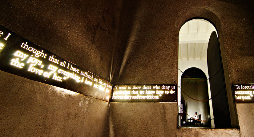
Jose Rizal wrote his farewell letter, Mi Ultimo Adios, while being held in a prison cell in Fort Santiago. Now the cell has been converted as the Rizal Shrine where a life-size diorama of his last hours is depicted before his execution. Creative Commons photo by Christian Sangoyo.
Scratch a stone in Manila and you’ll dig up all kinds of interesting history, right? By the way, the Creative Commons image below is by Fechi Fajardo. If you’re wondering what that net is, it’s a practice driving range for the Intramuros golf course! Oh, what would Rizal think?


 Have you heard romantic stories of evenings strolling on the
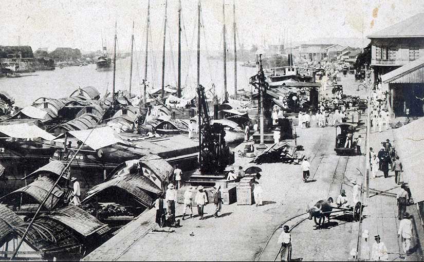

 It was supposed to cost
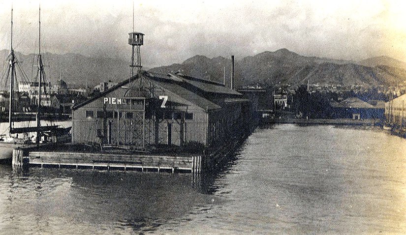
 Every vessel that entered the city—from local